Introduction
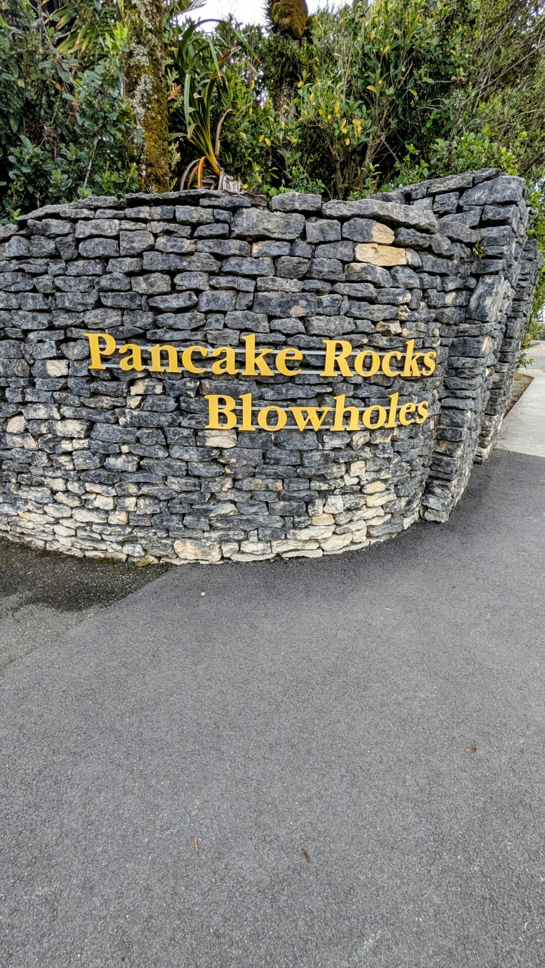
New Zealand is not a country that struggles to impress. After a week on the West Coast you’ve seen glaciers, impossible turquoise gorges, mirror lakes reflecting snowcapped peaks, and beaches made of black iron-sand under dramatic storm skies. The bar is objectively high. And then you round a corner on SH6 near Punakaiki, pull into the car park, walk approximately 800 metres, and find yourself standing in front of a coastline that looks like someone stacked enormous grey pancakes on top of each other, filled the gaps with seawater, and then ran high-pressure ocean jets through the whole arrangement for theatrical effect.
The Pancake Rocks are exactly what they sound like and considerably more than you’d expect from a name that sounds like a breakfast menu item. The blowholes, which channel incoming swells through channels in the rock and erupt with genuine force and noise, add the kind of kinetic drama that makes you involuntarily step back and then lean forward again immediately. The whole thing takes under half an hour and costs nothing except the time it takes to pull off the highway.
It is, with no qualification, one of the best short stops in the country.
What You’re Actually Looking At (The Brief Science Bit)
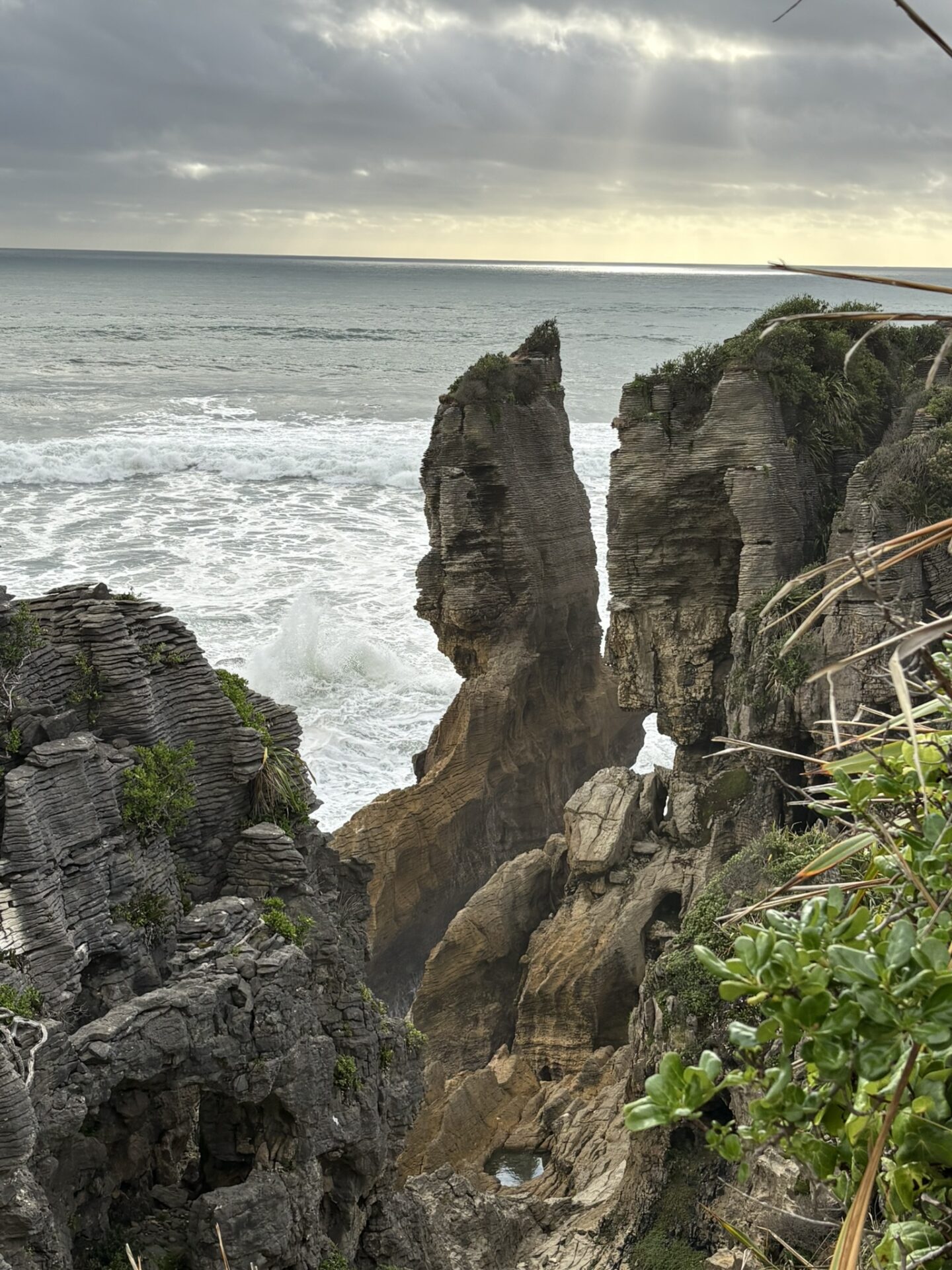
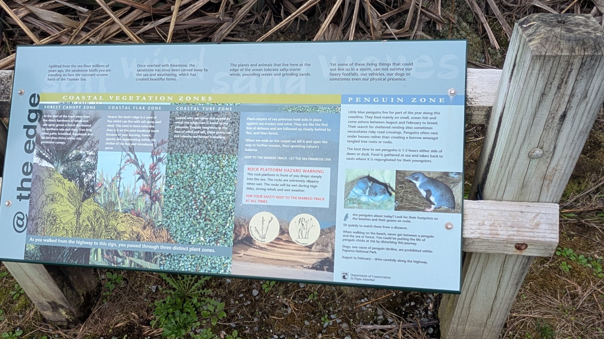
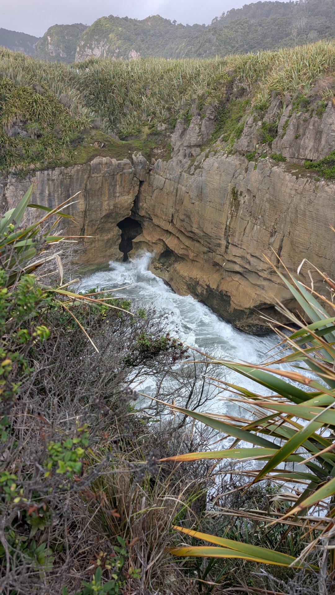
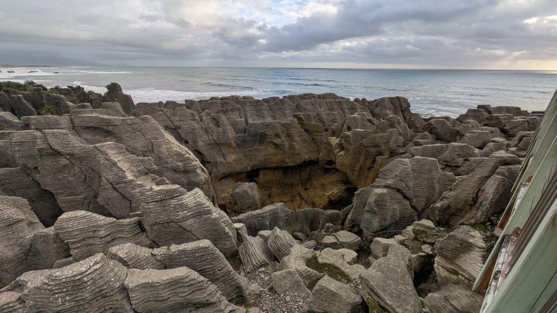
The Pancake Rocks at Dolomite Point are formed from alternating layers of hard limestone and softer mudstone, deposited on the seabed roughly 30 million years ago and compressed over time into the distinctive horizontal banding that gives them their name. Weathering — wind, salt spray, and rain — erodes the softer layers faster than the harder ones, producing the layered, stacked appearance that makes them look engineered rather than natural.
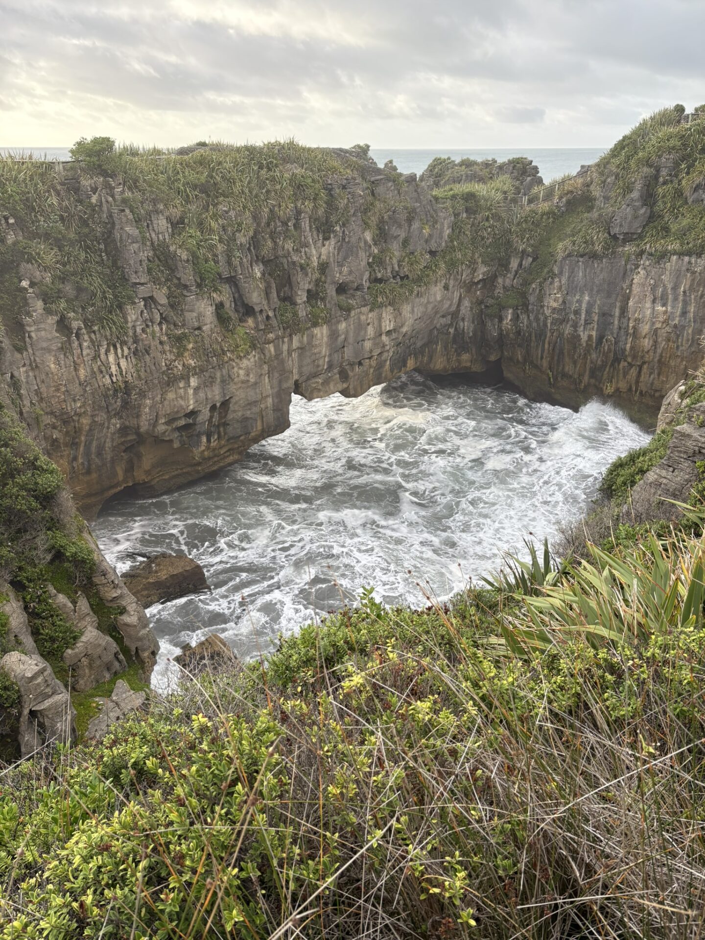
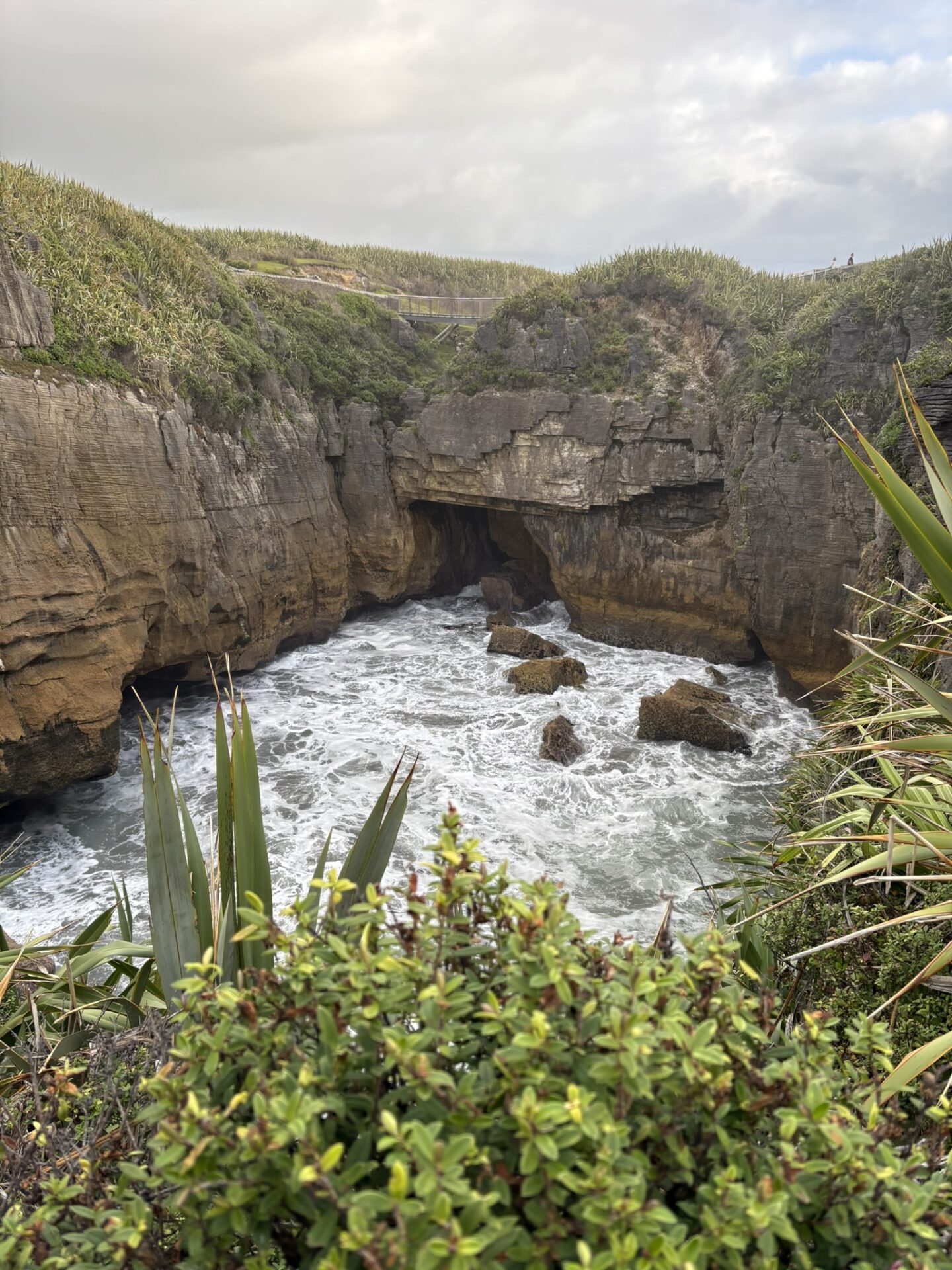
The blowholes are created by the same process: as the rock erodes, sea caves and channels form beneath the surface, and incoming swells compress air and water through narrow openings with considerable force. At high tide with a solid southwesterly swell running — the Tasman Sea delivers both reliably — the blowholes shoot seawater several metres into the air with a sound that arrives a fraction before the water does and suggests the rock is doing something it’s moderately annoyed about.
The best blowhole action is at high tide, which is worth checking before you visit.
Route Overview
- Distance: Approximately 1.2km loop
- Elevation Gain: Minimal — this is a coastal loop on formed paths and boardwalk
- Moving Time: 20–30 minutes at a comfortable pace; longer if you linger (you will linger)
- Difficulty: Easy — suitable for most fitness levels and most footwear
- Track Type: Loop, returning to the same car park
- Parking: Large free car park at the Punakaiki visitor centre, SH6
- Facilities: Toilets and a visitor centre at the car park
- Best Conditions: High tide, incoming swell, for maximum blowhole activity
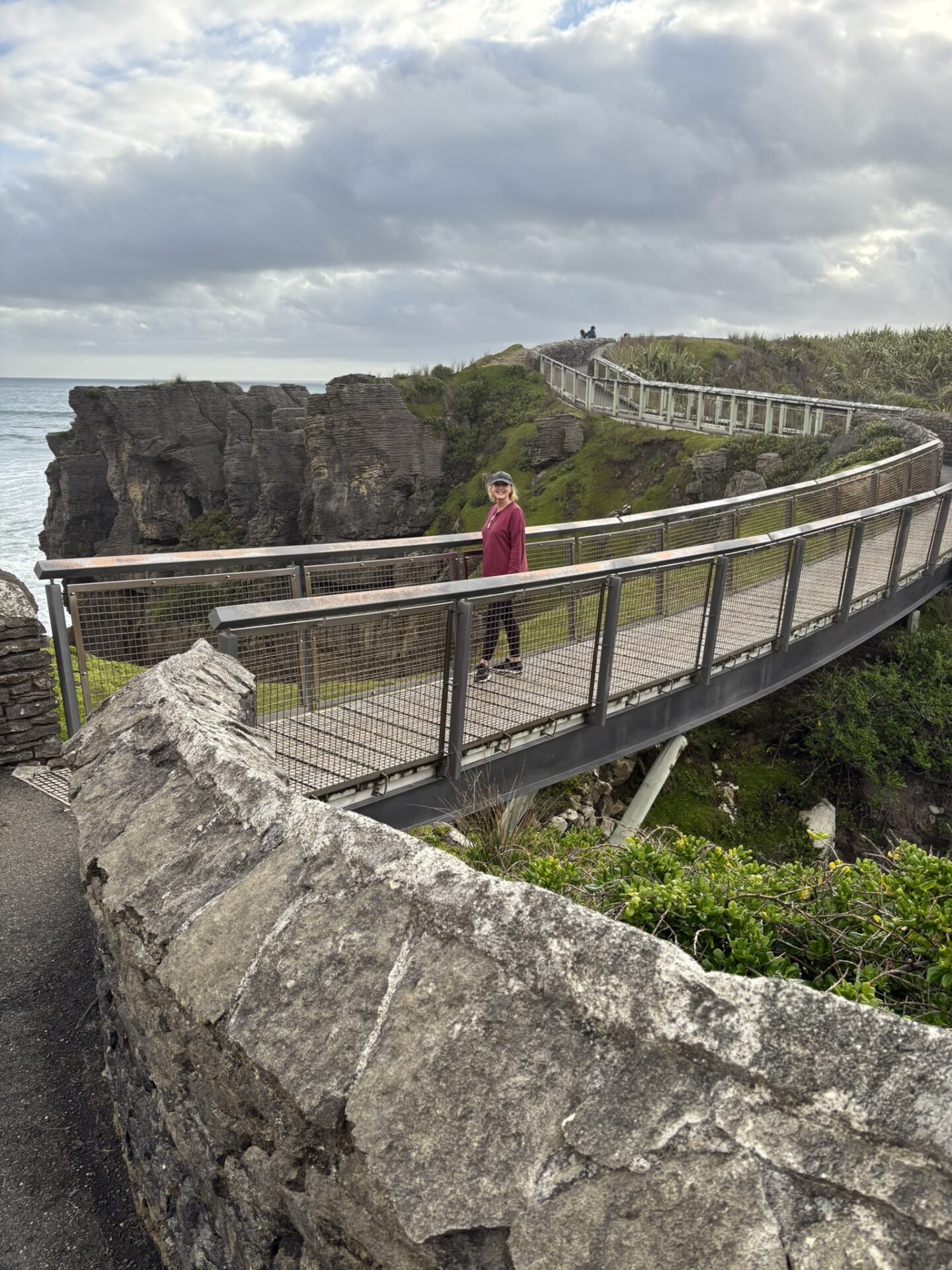
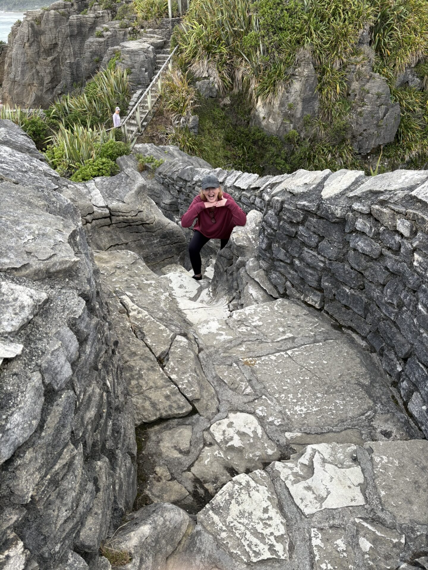
The loop departs from the visitor centre car park, moves out to Dolomite Point through the pancake rock formations, passes the main blowhole viewing area, and returns via a slightly different path. It is entirely accessible, entirely paved or boarded, and entirely extraordinary. The viewing platforms at the blowholes are well-positioned and safe, though the spray range on a good day is worth keeping in mind if you’d prefer your camera to remain dry.
The Walk
The Formations: Better in Person Than in Every Photograph of Them
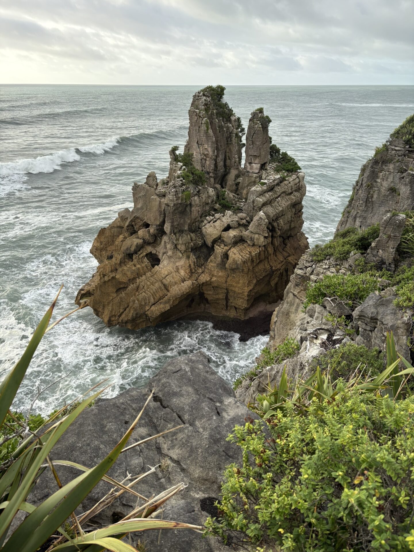
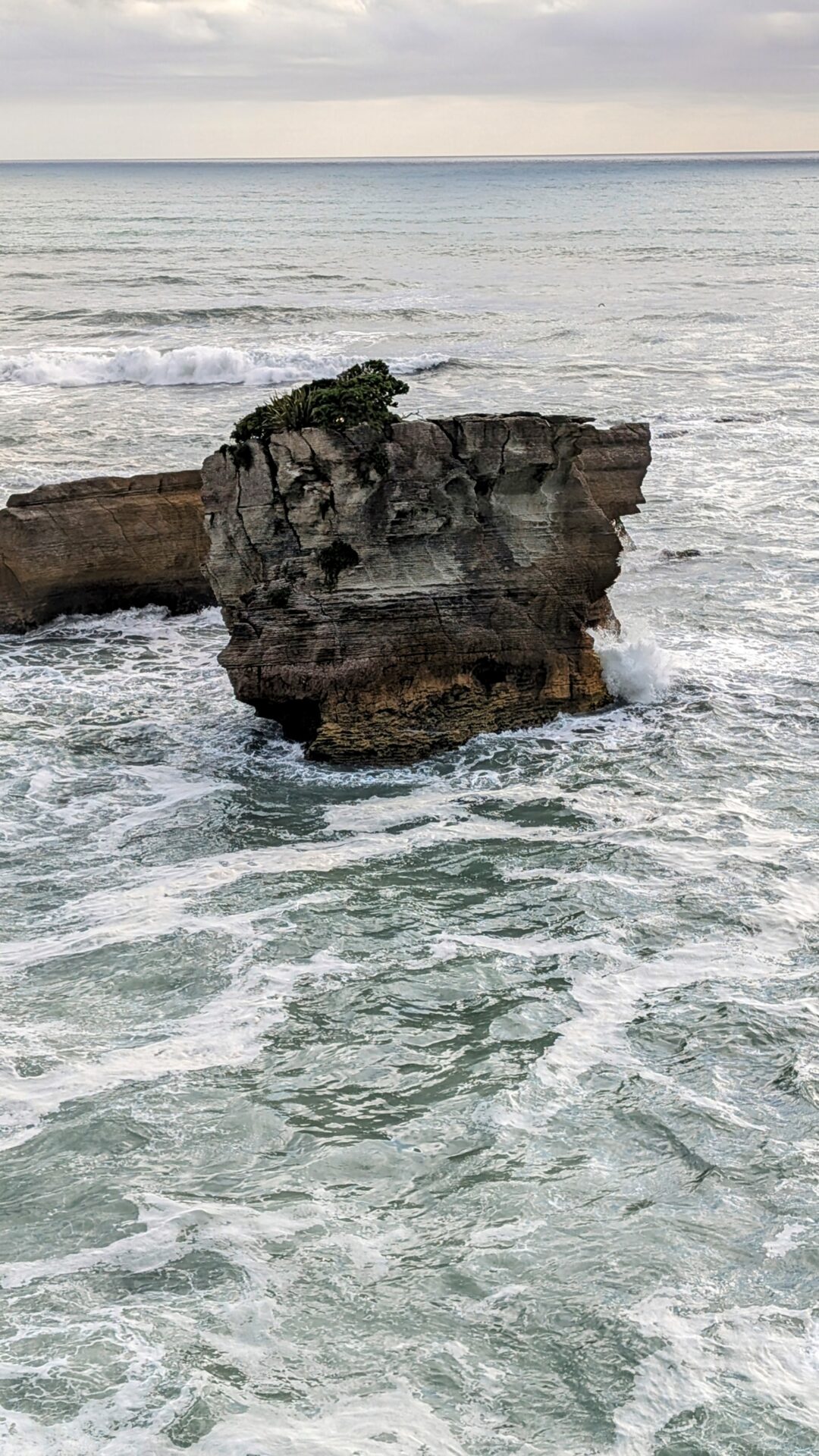
The first section of the loop moves through the pancake rock formations themselves, which is where the geology earns its name most clearly. The stacked, layered columns of limestone rise around the path, some tilted at angles that suggest significant geological events in their past, others standing as vertical as architecture. The scale is hard to convey in photographs — the formations are taller than you expect and denser than the aerial shots suggest, and walking among them rather than looking at them from above is a different experience entirely.
The rock surface is textured and pitted from centuries of salt weathering, and the colours shift from grey-white in direct light to almost blue in shadow. Tufts of coastal vegetation occupy crevices throughout. The whole formation feels simultaneously ancient and unstable, which is accurate on both counts — the erosion that created the pancake effect is ongoing, and the coastline here is slowly, geologically, changing.
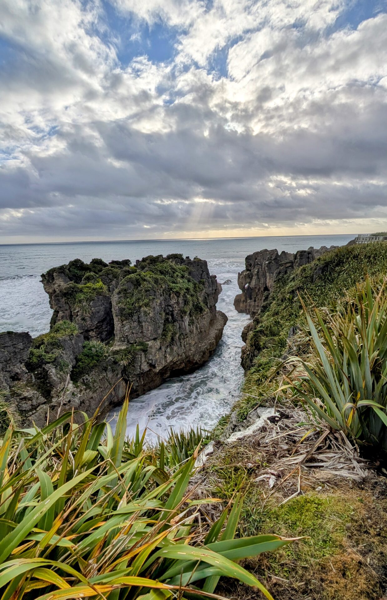
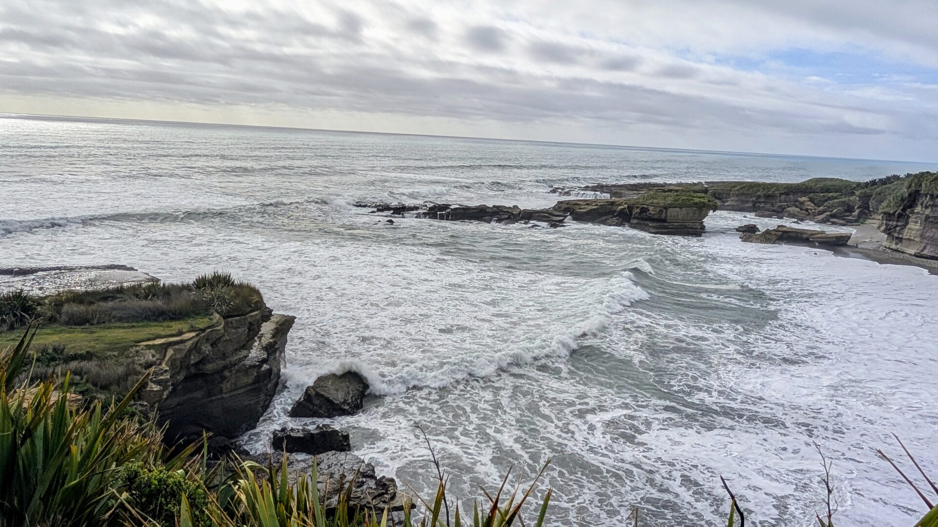
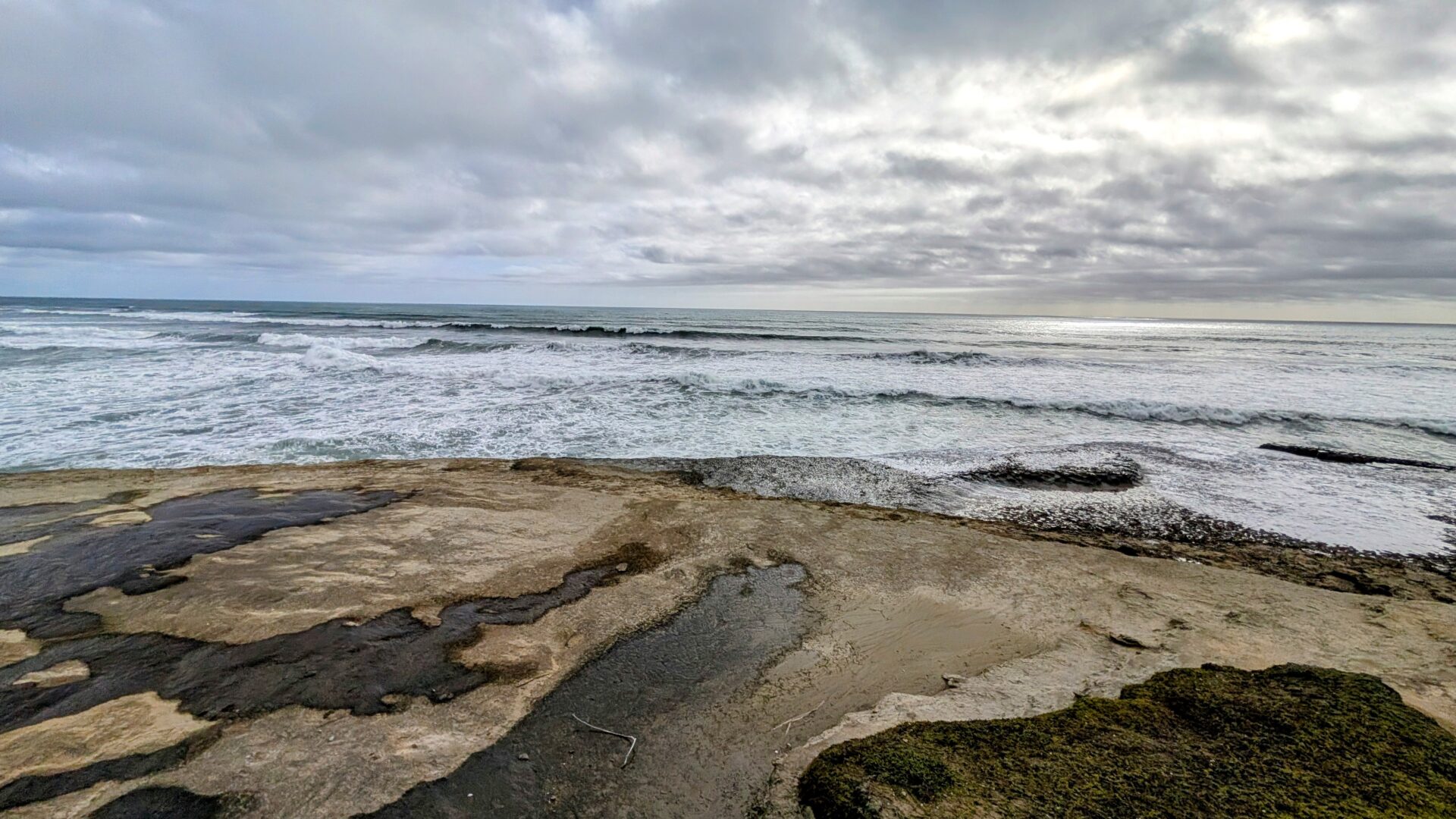
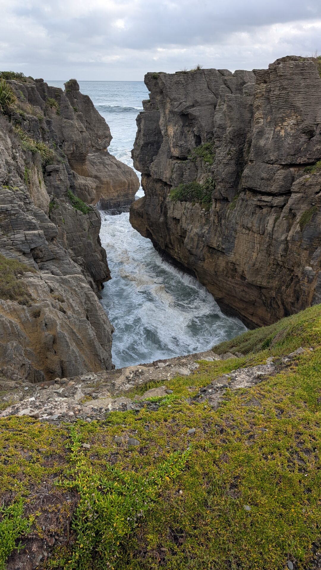
The Blowholes: The Tasman Sea Making a Point
The blowhole viewing platforms are the climax of the loop, and they deliver in direct proportion to what the ocean decides to contribute on any given day. At high tide with a good swell, the main blowhole erupts with a force and regularity that draws involuntary crowd reactions — a noise like a pressure valve releasing, a pause, and then a column of white water and spray that clears the rock surface by several metres and drifts across the viewing area depending on wind direction.
On a calm day at low tide, the blowholes gurgle more than erupt. This is still interesting and the rock formations remain spectacular, but the full theatre requires the Tasman Sea’s active participation. Check the tide tables. The difference between a mediocre blowhole day and a great one is the difference between watching someone describe an explosion and watching the explosion.
[The platform closest to the main blowhole has the best direct view but also the most spray exposure. Position yourself accordingly and point your camera away from the wind.]
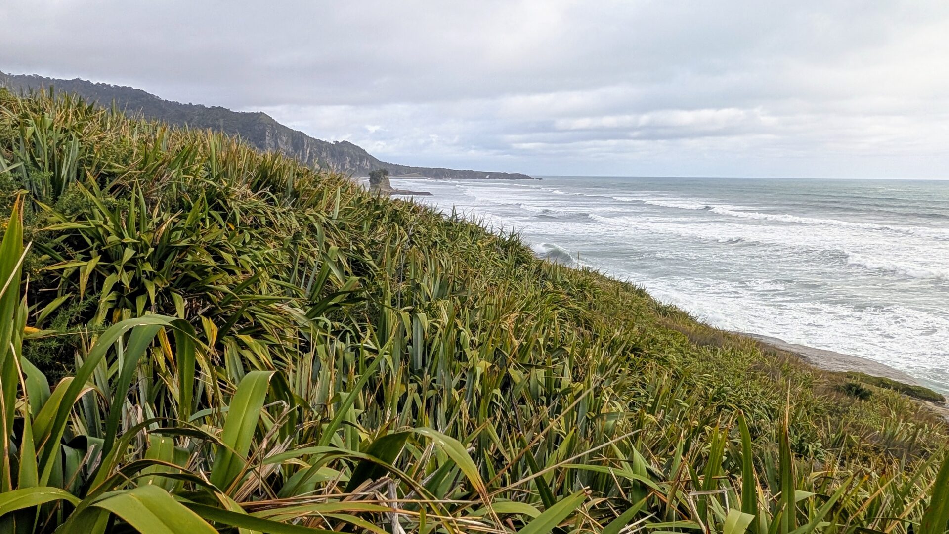
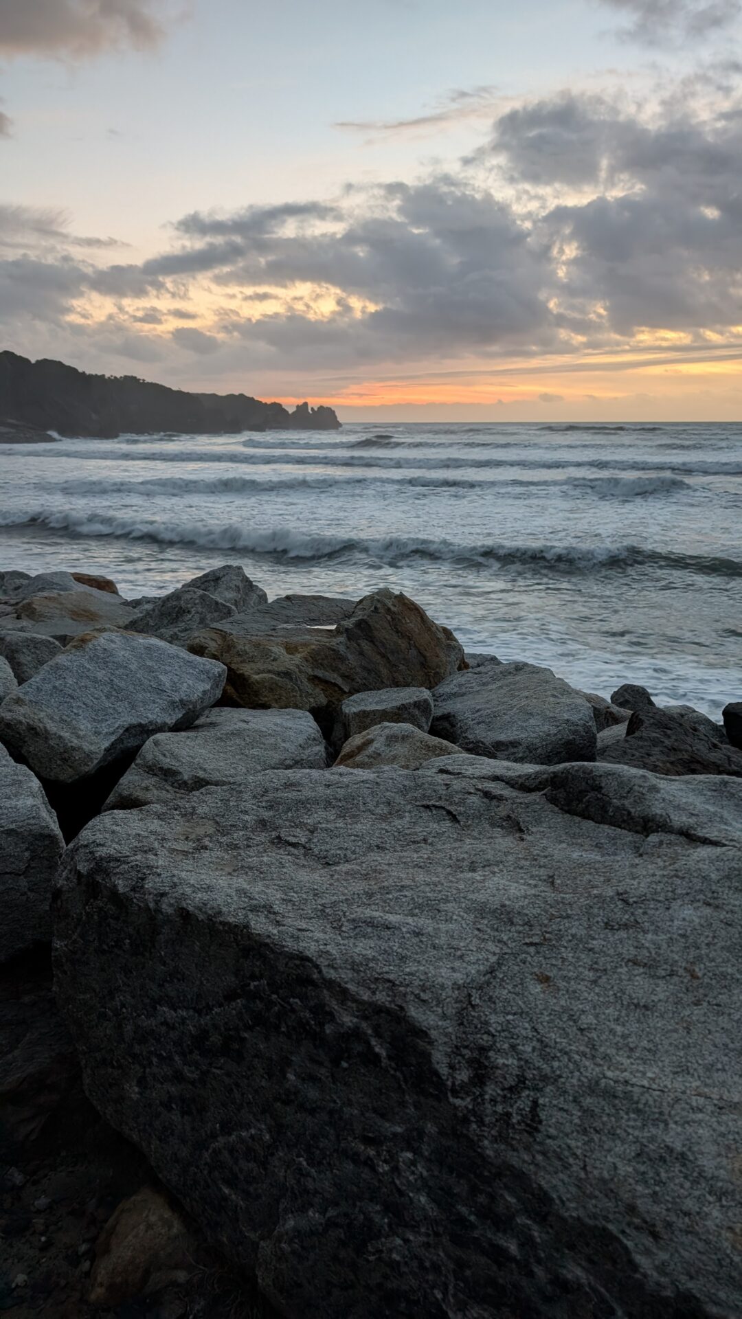
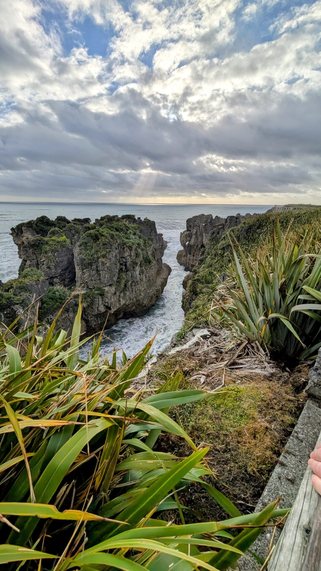
The Return Loop: Coastal Views Worth Slowing Down For
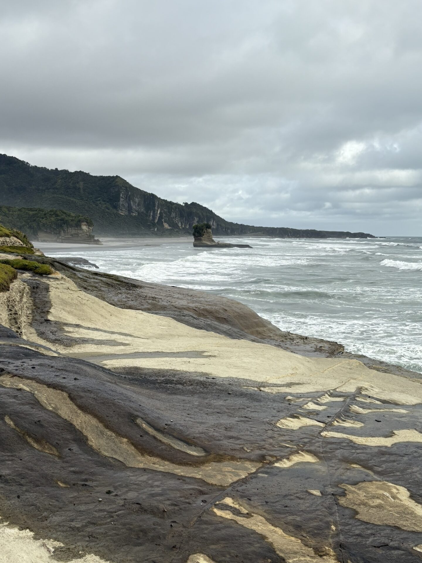
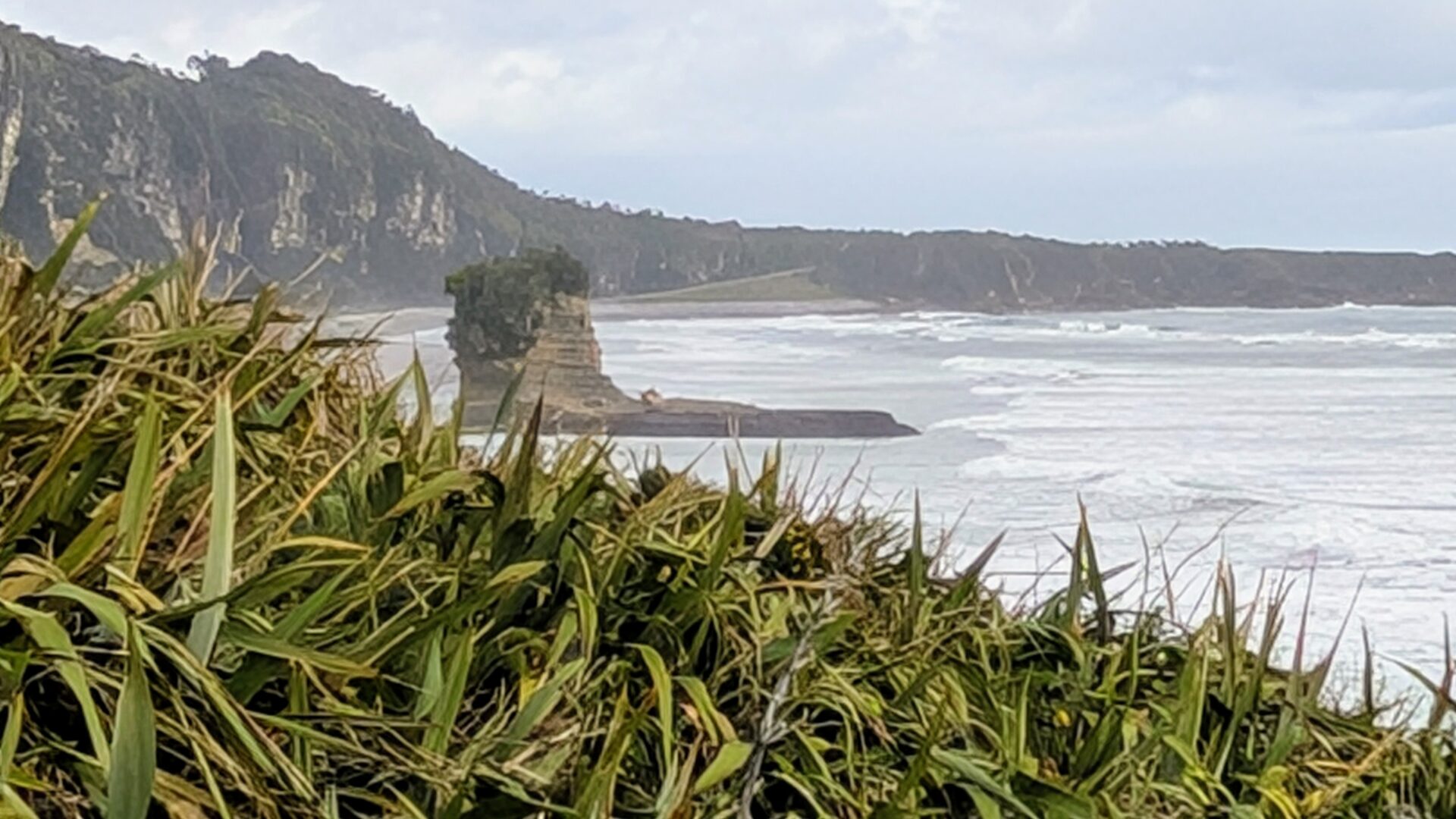
The return section of the loop follows the clifftop with views south and north along the West Coast — the Paparoa Range rising steeply inland, the Tasman Sea running to the horizon westward, and the rock platform below the cliffs showing the full extent of the pancake formation from above. This is where the scale becomes fully apparent: what you walked through is just one section of a coastline that extends along Dolomite Point in both directions, all of it the same improbable geology.
The light on the return section in late afternoon can be extraordinary — low sun on the grey-white limestone with the dark Tasman behind it, the coast stretching south toward Greymouth. If you have any interest in coastal photography, slow down here.
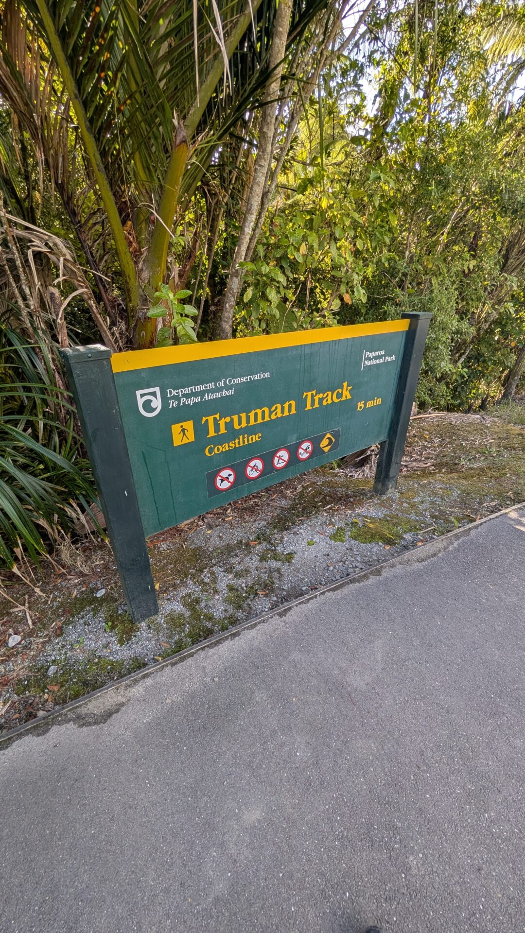
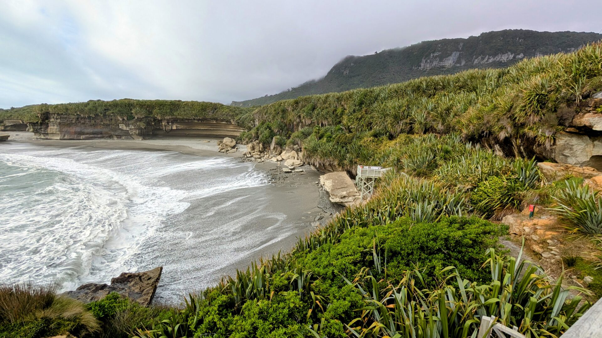
The Truman Track: Add This If You Have 45 Minutes
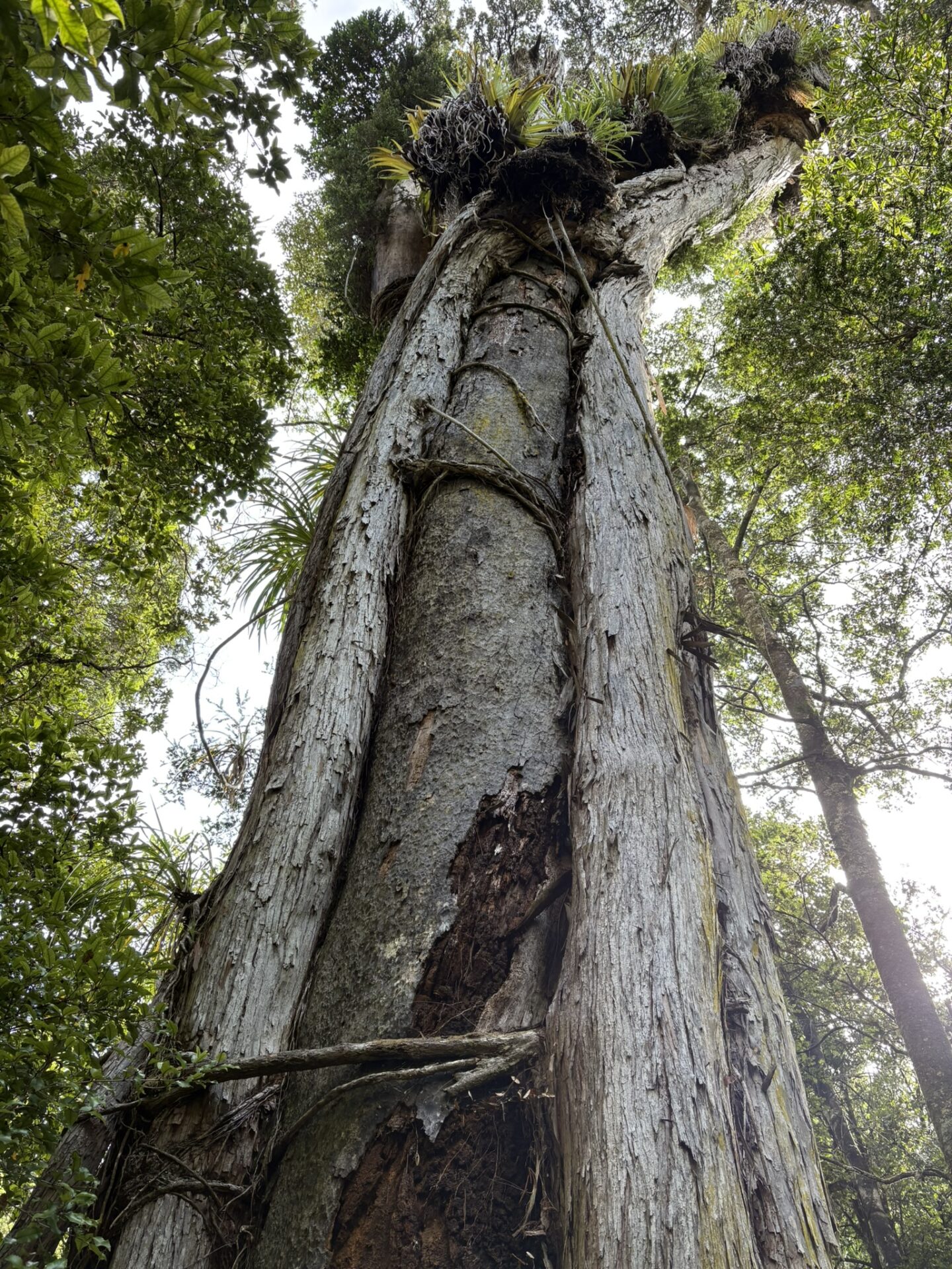
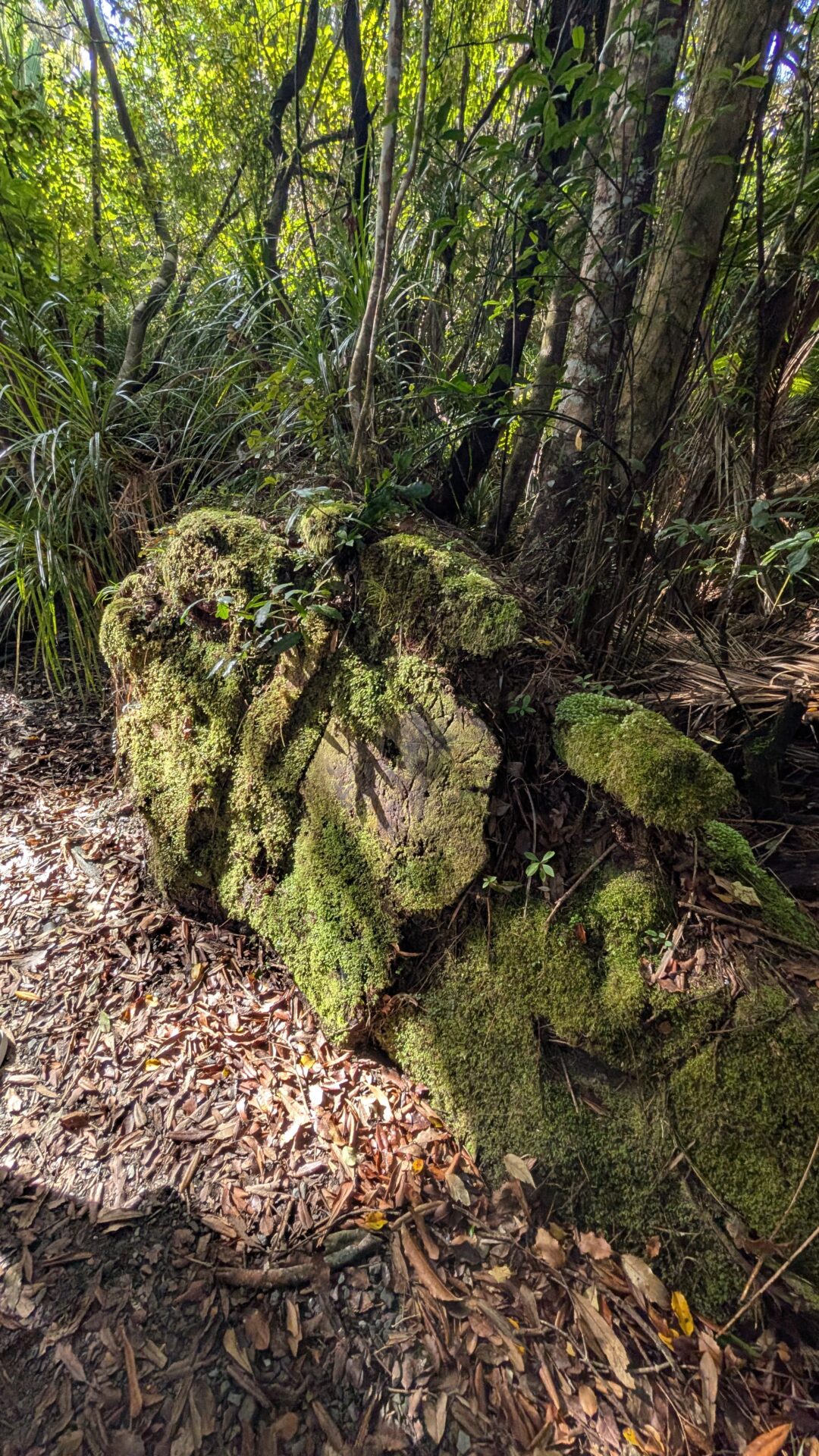
Approximately 3km north of the Pancake Rocks car park on SH6, the Truman Track is a short, separate walk that deserves its own mention and your remaining time. The track runs for roughly 20 minutes each way through dense coastal forest — nikau palms, supplejack, and ancient podocarp — before emerging at a small sandy cove and coastal viewpoint that feels completely removed from the highway you parked beside.
The Truman Track doesn’t have the geological drama of the Pancake Rocks and it doesn’t try to. What it has is the particular atmosphere of West Coast coastal forest — dark, close, dripping, alive in a way that feels slightly prehistoric — opening suddenly onto a raw coastal headland with views both north and south along a coastline that sees very few visitors despite being 3km from one of the most-visited spots on SH6.
If the Pancake Rocks walk is the showpiece, the Truman Track is the palate cleanser: quieter, more immersive, and a reminder that the West Coast has depth beyond its headline acts. Do the Pancake Rocks first, drive 3km north, and do the Truman Track before continuing south or north. The combined time investment is under two hours and the contrast between the two experiences makes both better.
What to Pack
For a 20-minute loop from a fully serviced car park, the packing list is short. But the West Coast has opinions:
- Waterproof jacket — not optional on the West Coast at any time of year. The blowholes add localised spray to the general weather uncertainty. A shell jacket weighs nothing and covers both.
- Sandfly repellent — you know this by now. Apply at the car park. The Truman Track in particular, with its dense coastal forest, is sandfly territory of the first order.
- Camera — the blowholes reward burst mode and patience. The formations reward wide-angle. The coastal return rewards whatever light you’re given.
- Tide table — look it up before you leave wherever you’re staying. High tide for maximum blowhole action. It takes 30 seconds and potentially transforms the experience.
Seasonal Considerations
Summer (December–February): The car park is busy and the walk is popular. The formations and blowholes are equally good in any season — what changes is the swell and the light, not the geology. A fine summer evening here, with the low light on the limestone and the Tasman glittering, is among the better versions of the West Coast.
Autumn (March–May): Fewer people, consistent swell as the Southern Ocean becomes more active, and the surrounding Paparoa Range forest takes on depth and colour. One of the better seasons for blowhole action.
Winter (June–August): The West Coast in winter is properly elemental, and Dolomite Point in a winter swell is about as dramatic as an accessible coastal walk gets. The blowholes perform at their best when the sea is at its most committed. Dress for full West Coast winter — waterproof everything — and you’ll have the place largely to yourself.
Spring (September–November): Variable and vivid. The swell is building, the surrounding greenery is at its most intense, and the visitor numbers haven’t yet peaked. A good season for both the photography and the solitude.
Common Mistakes to Avoid
- Going at low tide on a calm day and wondering what the fuss is about. The fuss requires water. Check the tide table.
- Rushing the formation section to get to the blowholes. The pancake rocks themselves are extraordinary geology and deserve ten minutes of your attention before you race to the erupting bit.
- Skipping the Truman Track. It’s 3km up the road and 45 minutes of your time for a completely different West Coast experience. Do not drive past it.
- Standing directly downwind of an active blowhole with an uncovered camera. The spray is saltwater. Salt and camera electronics have a well-documented relationship.
- Forgetting this is still the West Coast. The weather can change in 20 minutes. The fact that the walk is short doesn’t mean a waterproof jacket is unnecessary.
FAQs
When is the best time to visit Pancake Rocks? High tide, ideally with a solid southwesterly swell running. Check the tide tables for Westport or Greymouth (the nearest reference points) and time your arrival for within an hour either side of high tide. The formations are worth seeing regardless, but the blowholes are significantly more impressive with a cooperative ocean.
How long does the Pancake Rocks walk take? The loop is under 30 minutes at a comfortable pace. Budget 45 minutes to an hour if you want to spend time at the blowhole platforms and on the coastal return section — which you should.
Is the walk suitable for children? Yes. The loop is short, well-formed, and interesting enough at every point to hold a child’s attention. The blowholes are genuinely exciting for any age. Keep small children away from the cliff edges on the return section, which are unfenced in places.
Do I need to pay to visit Pancake Rocks? No. The walk and the car park are free. The visitor centre has interpretive displays and a café.
What’s the difference between the Pancake Rocks walk and the Truman Track? The Pancake Rocks walk is a 20–30 minute coastal loop focused on geological formations and blowholes, right at the main Punakaiki visitor car park. The Truman Track is a separate 40-minute return walk through coastal forest to a headland viewpoint, 3km north on SH6. They complement each other perfectly and together make a complete Punakaiki morning.
Can I hear the blowholes before I see them? On a good day, yes. The sound arrives first — a deep, pressurised exhalation from somewhere below the rock surface — and then the water follows. It is the West Coast providing a formal introduction.
Conclusion: Twenty Minutes, Thirty Million Years, Zero Regrets
The Pancake Rocks walk is the most efficient exchange of time for geological spectacle available on the West Coast. Twenty minutes of your day, no elevation to gain, no special gear required, and at the end of it you’ll have stood next to one of the more improbable pieces of coastline on the planet and watched the Tasman Sea express its feelings through a hole in a limestone stack.
That it sits directly on SH6, with a large free car park and functional toilets, and that it still feels somehow wild and raw and undomesticated, is the particular trick Punakaiki pulls. The highway is right there. The visitors are real. And the rock doesn’t care about any of it — it’s been stacking up and slowly dissolving for thirty million years and has no particular opinion about your schedule.
Drive north to the Truman Track after. Stand in the nikau forest for a minute before the path opens to the coast. Let the West Coast have both stops.
It’s earned them.
No AllTrails data — the loop is too short and too well-signed to need navigation assistance. Blowhole conditions at time of visit: active and opinionated. Sandfly conditions: as expected. Geological time scale: humbling.