Introduction
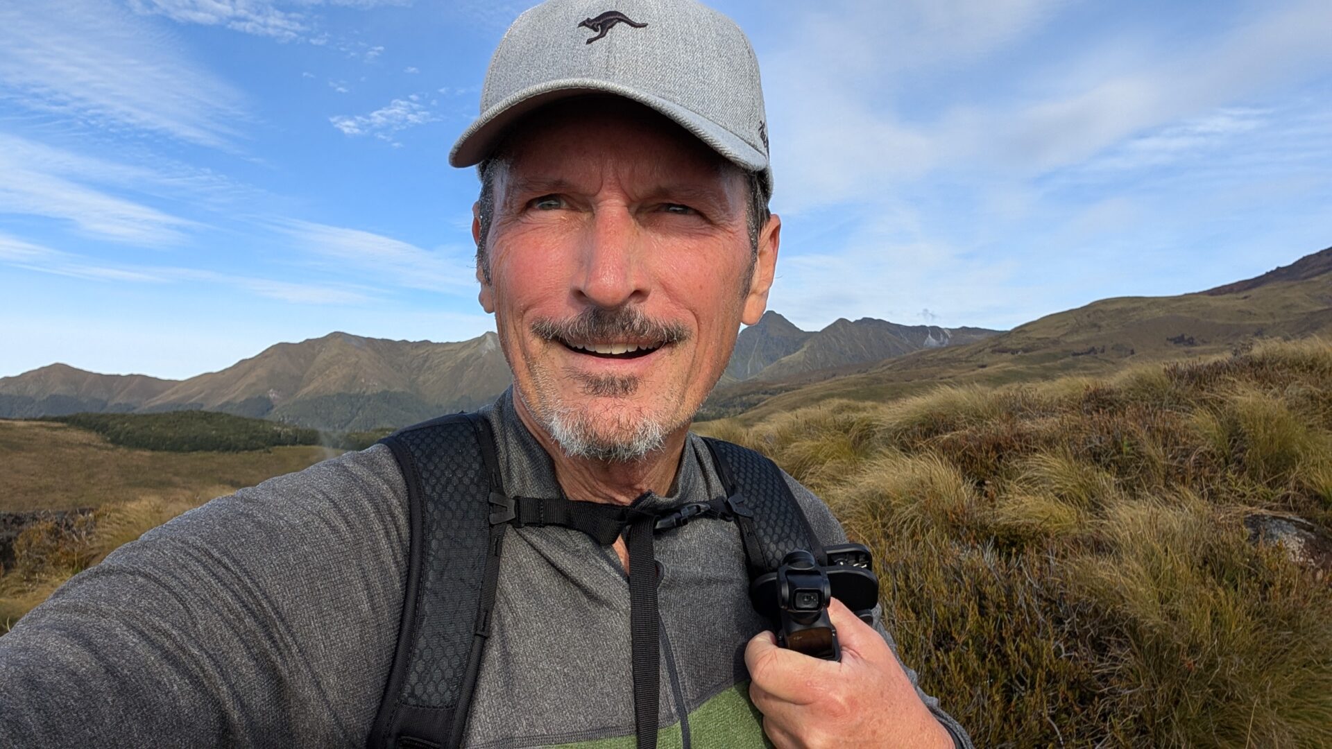
There’s a particular kind of person who shoots off a boat the moment it docks, overtakes everyone on the jetty, and disappears up a trail at a pace that suggests they’ve either trained seriously for this or simply haven’t registered yet that the mountain doesn’t care about their energy levels. On a clear morning at Brod Bay, I watched nine of them do exactly this while I stood on the launch, methodically packing my bag, checking my kit, and doing absolutely nothing that looked impressive.
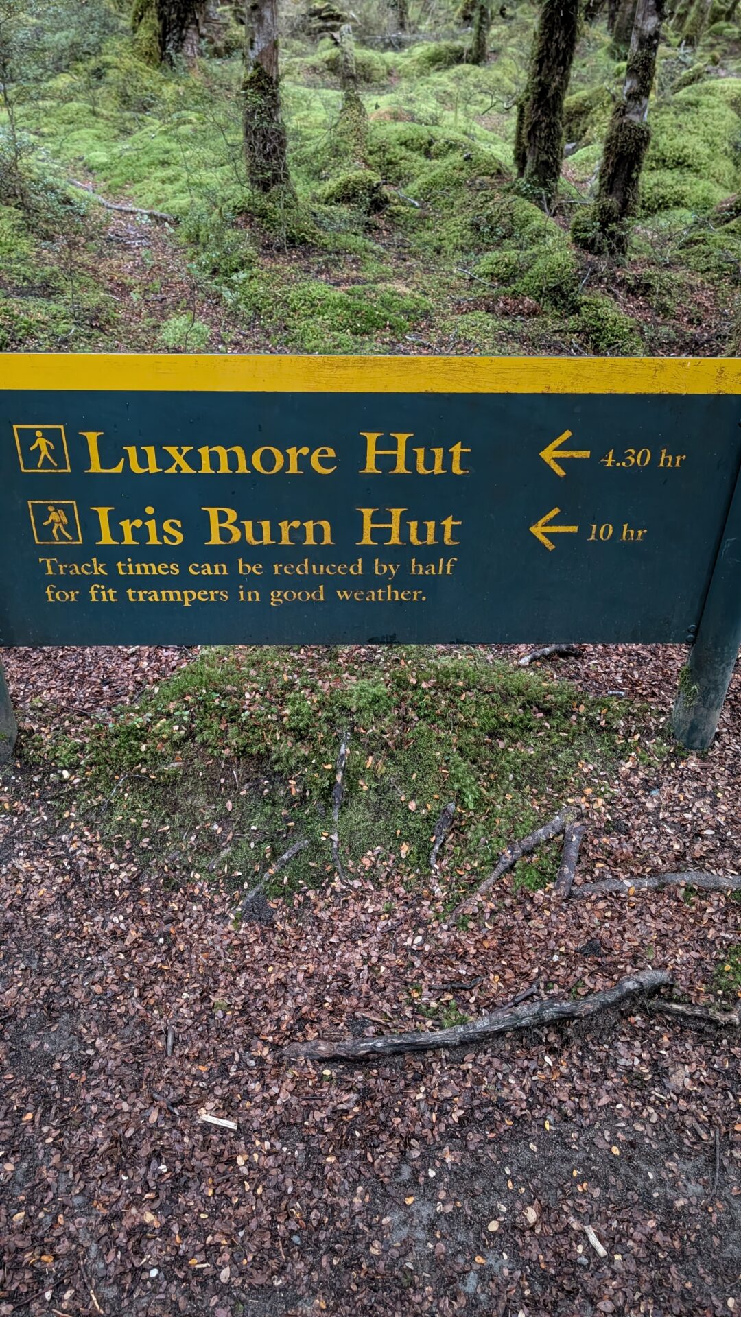
I mention this not to be smug — though I will be, briefly, in a moment — but because it sets up the central lesson of the Brod Bay to Mount Luxmore hike via the Kepler Track: this is a long game. At 12.25 miles and 3,314 feet of elevation gain, with a moving time of just over four hours, it rewards patience, rhythm, and the kind of steady uphill pace that looks almost disappointingly slow until it isn’t. I reached the summit of Mount Luxmore before every single one of those nine people. I was back at the bottom before some of them had even gotten to the top.
And then, because I had two hours to kill before the boat returned and found idleness philosophically disagreeable, I walked back to Te Anau on the lakeshore track. The full Kepler Track loop back via the carpark to Brod Bay Campsite and all the way to town. On legs that had already done all of the above.
This is the story of that day. It is a story about pacing, about New Zealand being unreasonably beautiful, and about the deeply human tendency to make decisions with our feet that our future selves will have opinions about.
Route Overview
- Main Hike: Brod Bay to Mount Luxmore (Kepler Track), return
- Distance: 12.25 miles
- Elevation Gain: 3,314 ft
- Moving Time: 4 hours 4 minutes
- Total Time: 4 hours 12 minutes
- Average Pace: 19:56/mile
- Calories Burned: 2,118
- Access: Morning launch from Te Anau to Brod Bay (book in advance — this is not a vague suggestion)
- Conditions: Great
- Difficulty: Hard, and it means it
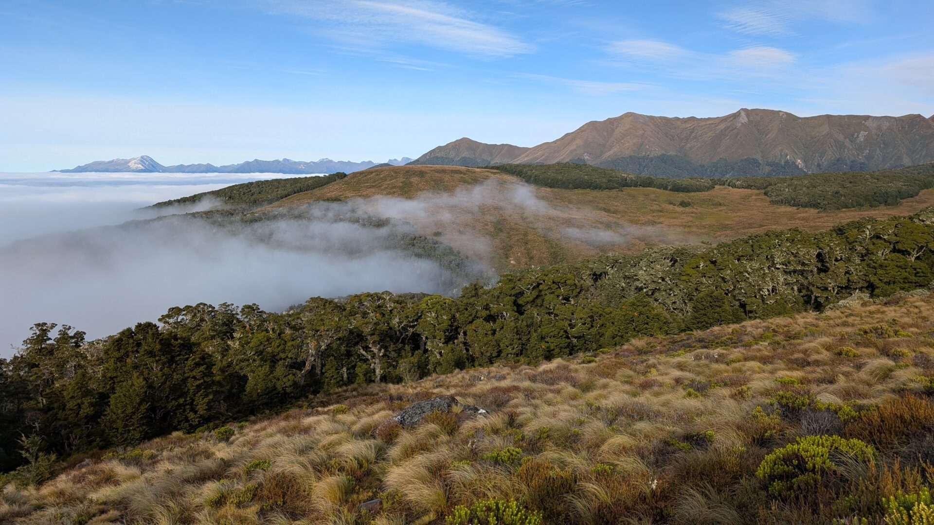
The Kepler Track is one of New Zealand’s Great Walks, which is the Department of Conservation’s way of saying: this one is genuinely extraordinary, please don’t show up unprepared. The section from Brod Bay to Mount Luxmore is the crown jewel of the first day’s stage — a sustained climb through beech forest that breaks out dramatically onto an exposed limestone ridge with views of Lake Te Anau, Lake Manapouri, and the Fiordland ranges that will make you stop walking not because you’re tired but because your brain needs a moment to process what it’s seeing.
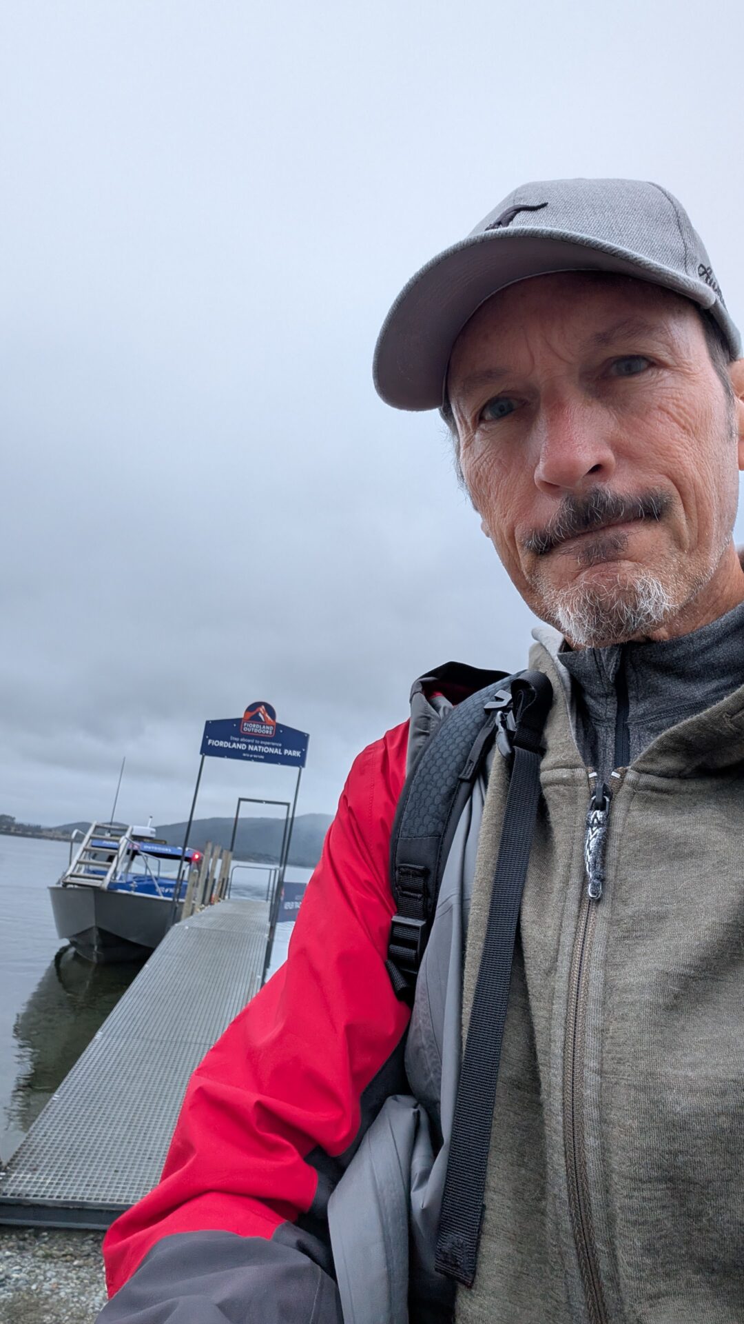
The launch from Te Anau township drops hikers at Brod Bay on the western shore of Lake Te Anau, cutting out the flat lakeshore section and depositing you directly at the foot of the climb. It is efficient, scenic, and — on the morning in question — the launching pad for an impromptu pace experiment involving nine millennials who had not yet met a proper mountain.
Trail Stages
Stage 1: The Beech Forest Climb (Finding Your Rhythm)
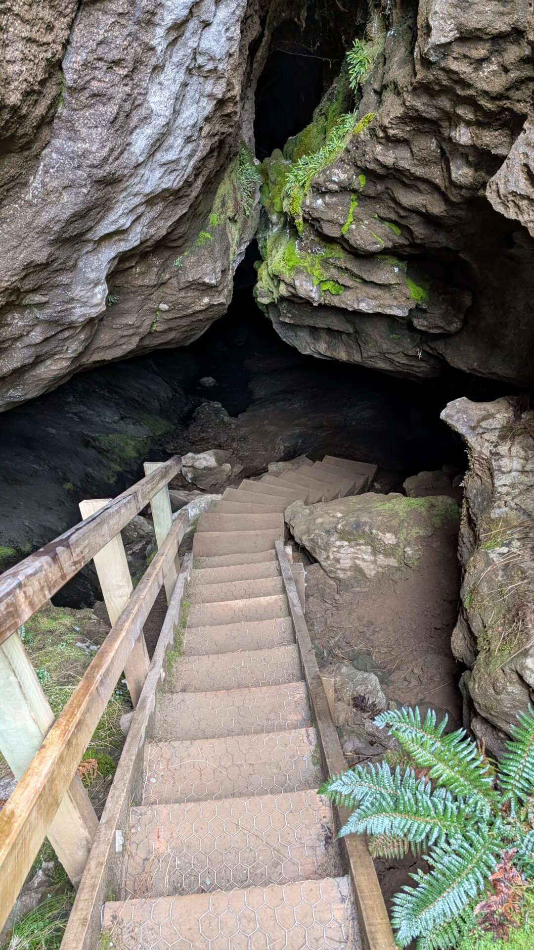
A quick note before you even hit the trail: if you’re spending a night in Te Anau before or after this hike — and you should be — do not miss the Te Anau Glowworm Caves. Accessed by a short boat trip across the lake from town, these are active limestone caves riddled with glowworms that turn the cave ceiling into something that looks implausibly like a night sky. It’s geological, it’s alive, and it’s quietly one of the most surreal things you can do in a country that does not suffer from a shortage of surreal things. Book it for the evening before your hike: it sets the tone for just how otherworldly this corner of New Zealand is, and it means you’ll step onto that launch the next morning already primed for the extraordinary.
Right. Into the forest.
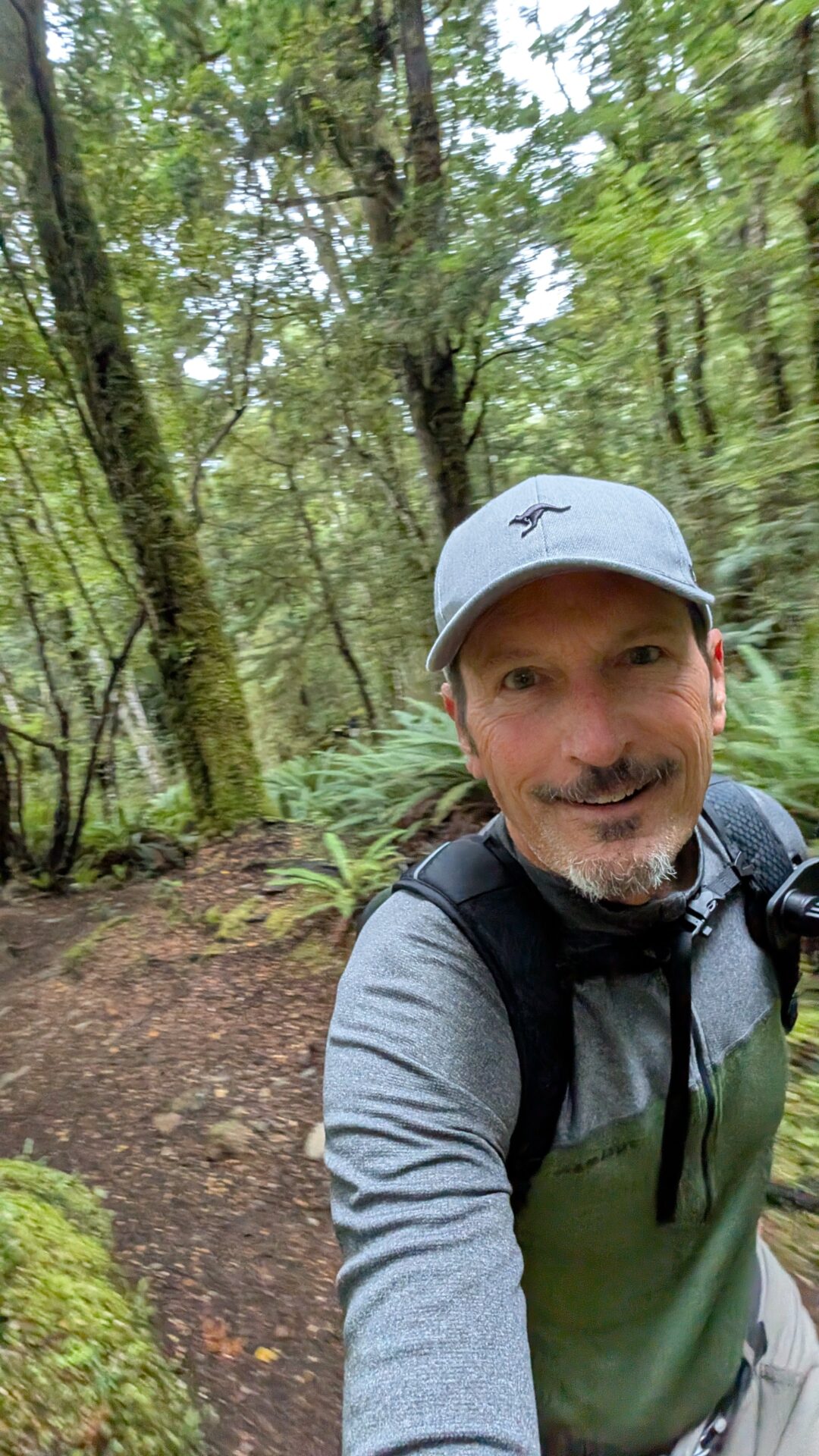
From Brod Bay, the trail rises almost immediately into dense southern beech forest. This is where rhythm lives. The gradient is consistent and the track is well-formed underfoot — roots, some mud in wet conditions, switchbacks that gain height steadily without ever feeling gratuitously cruel. It’s the kind of climbing that responds well to a measured, metronome-like pace: not slow, not hurried, just relentlessly forward.
The forest is magnificent in the way that Fiordland forests generally are — moss-thick, cathedral-quiet, with the occasional fantail darting across the track to remind you that you’re a guest here. If you’ve come from a city recently, the silence will take some adjustment. Lean into it.
This is also, notably, where the nine millennials from the launch began to string out along the trail, their early pace unsustainable over sustained elevation. The forest has a way of redistributing ambition fairly.
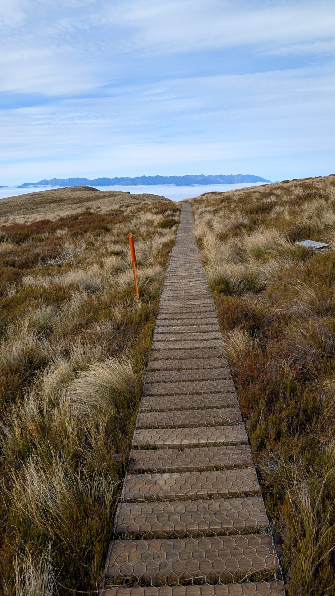
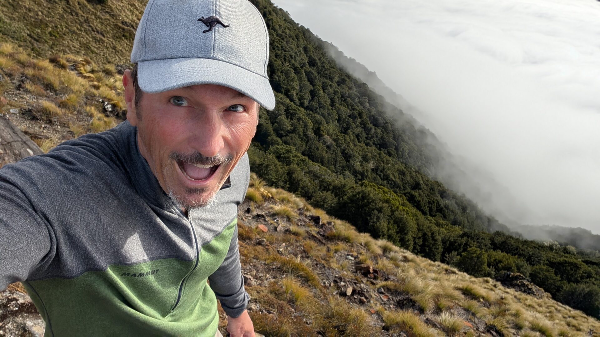
Stage 2: The Treeline and the Limestone Bluffs (The World Opens Up)
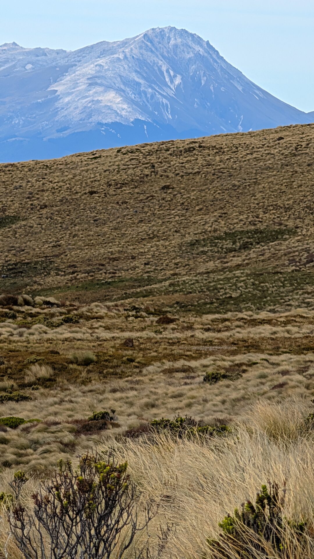
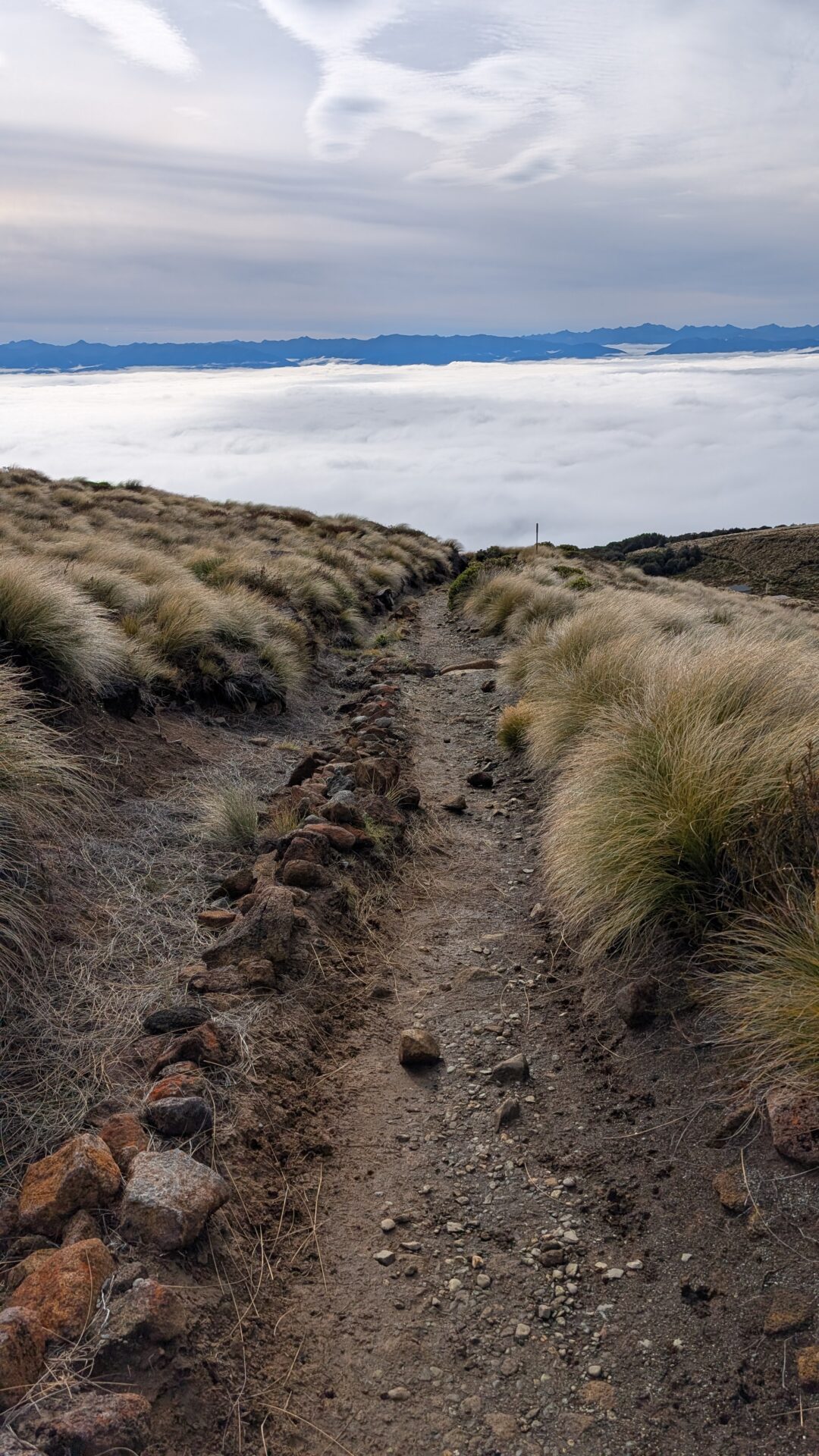
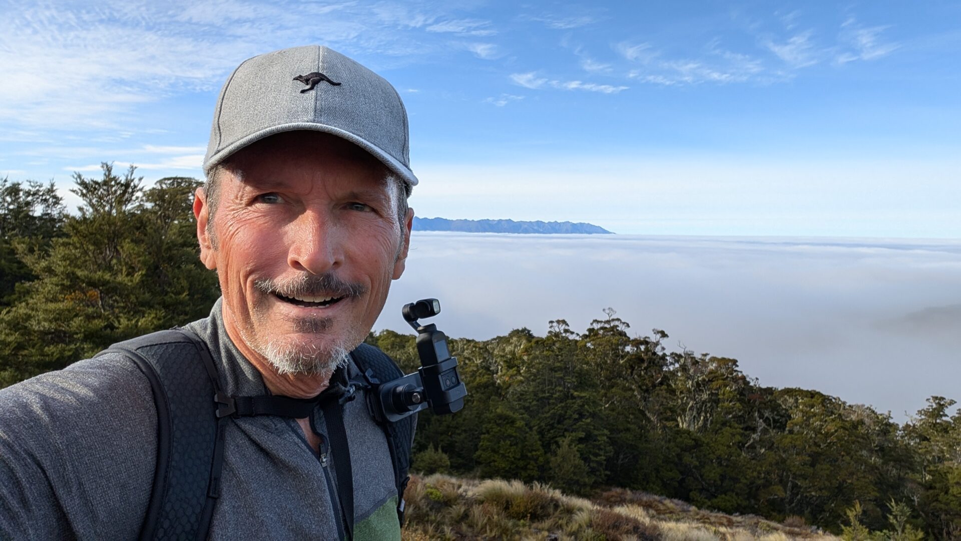
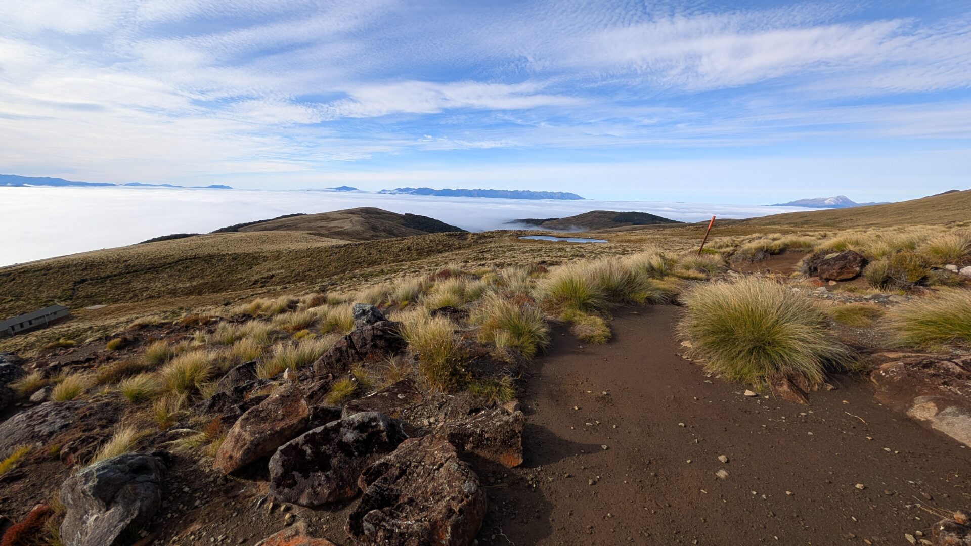
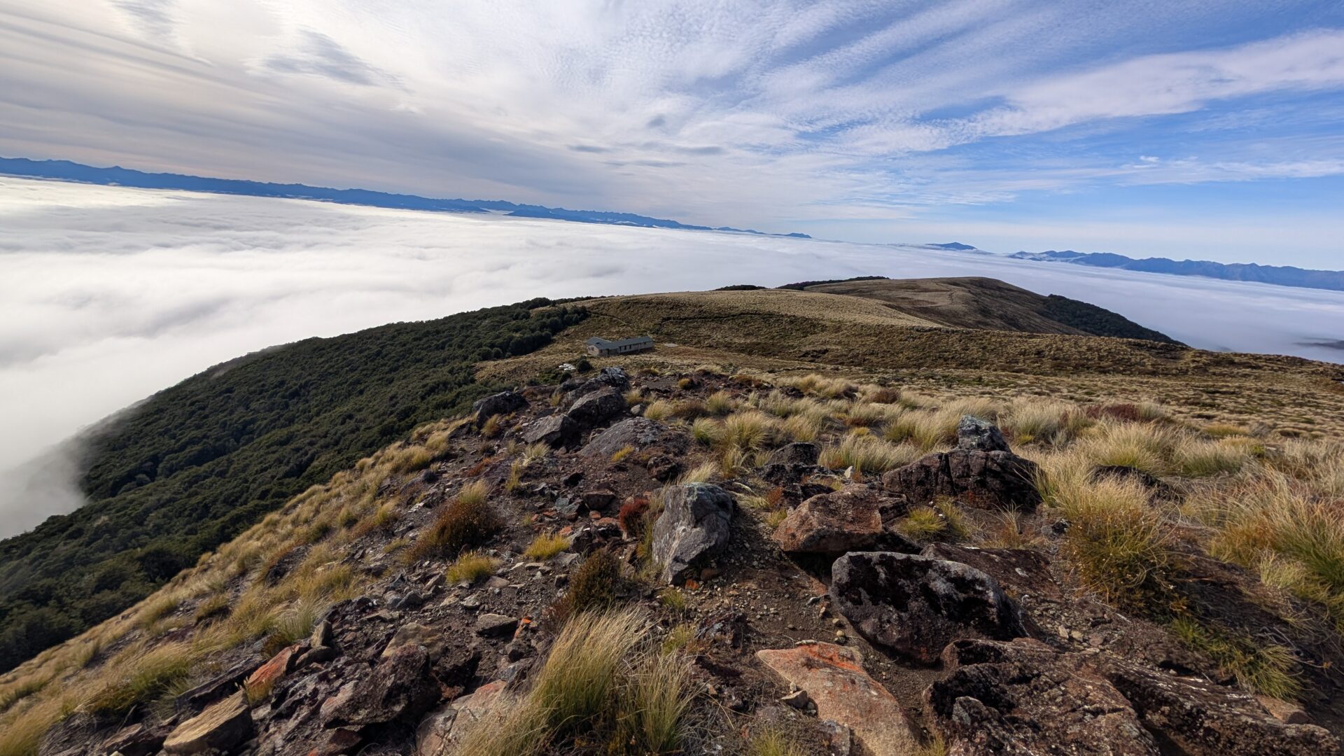
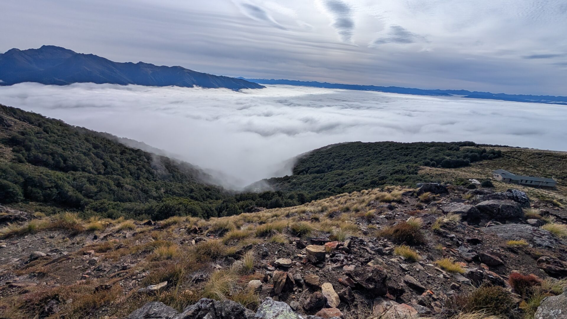
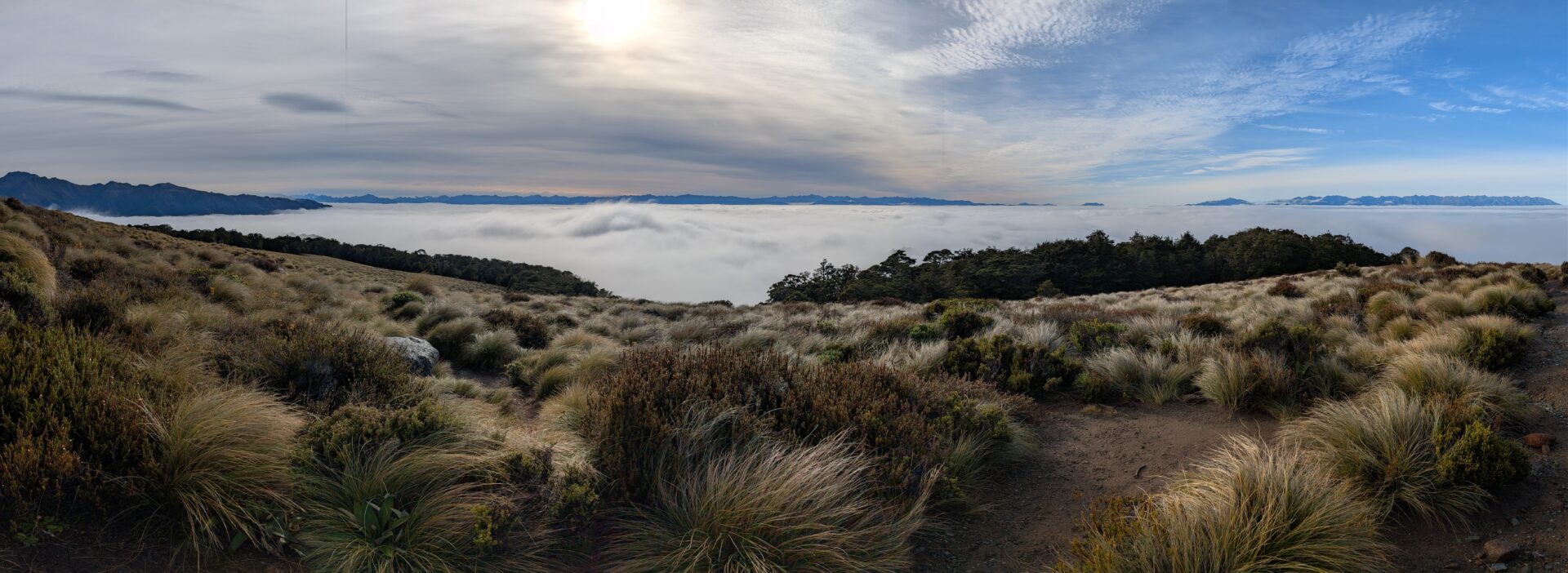
Somewhere above 3,000 feet, the beech forest gives way. The trees thin, the sky expands, and you step out onto the exposed ridge section with the kind of view that makes the previous two hours retroactively worth every step. Lake Te Anau spreads out below in shades of blue-green that feel digitally enhanced even when you’re standing in front of them. The Murchison Mountains rise across the water. To the south, Lake Manapouri appears.
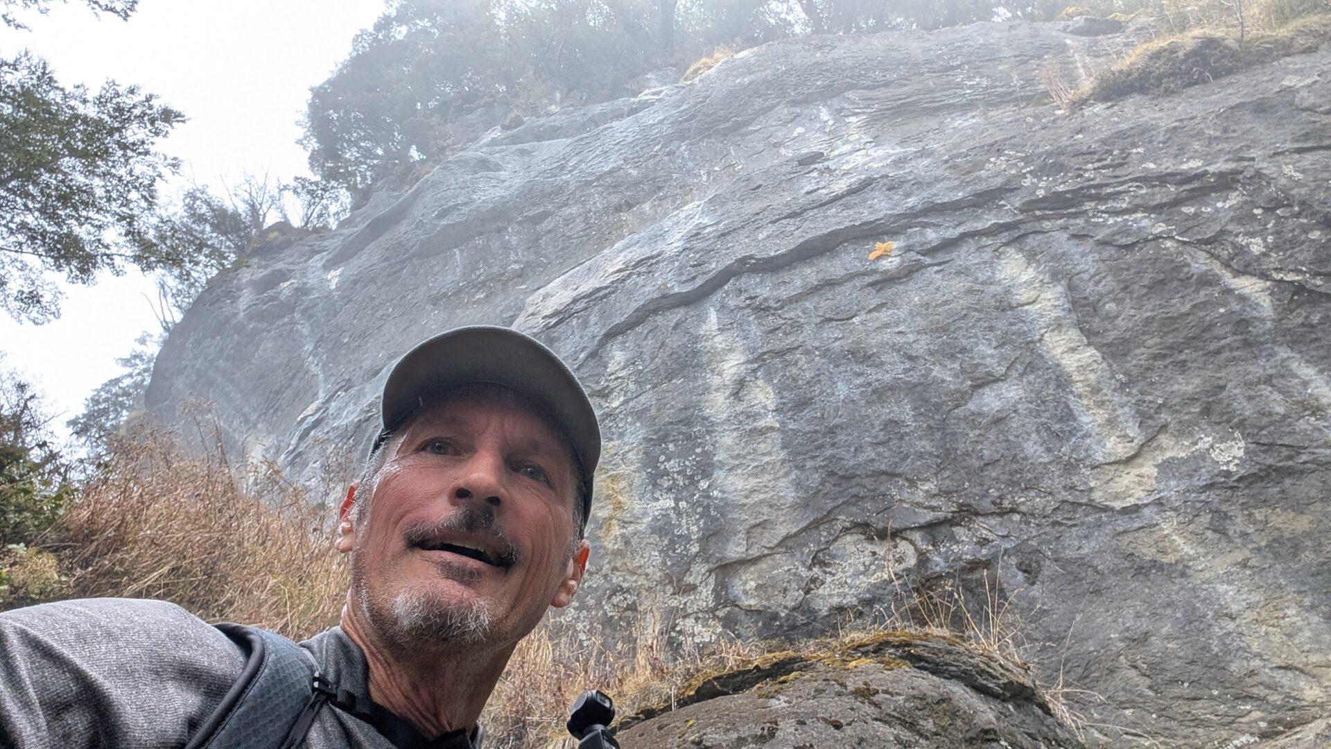
The limestone bluffs and rocky outcrops along this section are geologically interesting and photographically compulsive. The track follows the ridge with some exposure — nothing technical, but enough that you’ll want to pay attention on a windy day, and Fiordland can be very windy indeed. The weather here changes with a speed that suggests the atmosphere is simply not particularly committed to any one decision.
At this altitude, the sense of space is immense. You will almost certainly stop more than you intend to. This is correct behaviour.
Stage 3: Mount Luxmore Summit (The Long Game Pays Out)
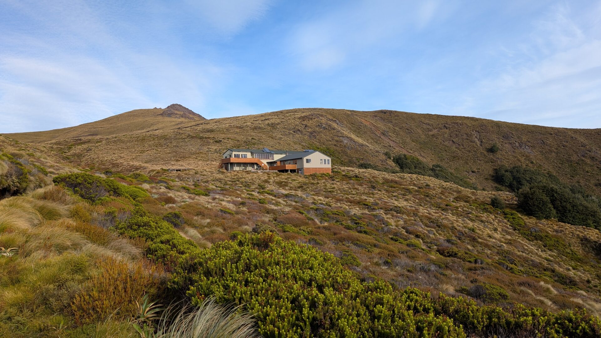
The final push to the Mount Luxmore summit hut and the peak itself is the reward section — elevation already banked, ridge walking replacing pure climbing, and the views expanding with every step north along the range. The summit hut sits just below the peak and offers shelter, a reason to stop, and in fine weather, a front-row seat to one of the better panoramas in the South Island.
The summit itself caps out at roughly 5,400 feet. On a clear day — and I had a clear day — the visibility extends to mountains you’d need a map to name. Kepler, Murchison, the Fiordland ranges rolling south toward Doubtful Sound. It is, without any exaggeration whatsoever, the kind of place that recalibrates your sense of scale.
I was here, resting comfortably, before the first of the nine people from the boat arrived at the top. I won’t pretend I didn’t notice.
Stage 4: The Return and the Unplanned Bonus Round
The descent back to Brod Bay retraces the route, which is either meditative or monotonous depending entirely on your temperament. At 2,118 calories burned, the legs are honest about their mileage by this point.
But here’s where the day took a turn: arriving back at Brod Bay to discover the launch was several hours out, I made the entirely rational decision that waiting was not an option. The lakeshore track from Brod Bay back to Te Anau is approximately 5.5 kilometres of flat, well-formed trail along the western edge of Lake Te Anau — beautiful, easy, and under normal circumstances a pleasant warm-down walk. After 12 miles and 3,314 feet of elevation gain, it has a different character entirely.
It was fine. The lake was spectacular. My feet had opinions. I arrived in Te Anau having covered a genuinely impressive amount of ground, on legs that had earned a serious meal and an early night, in that order.
What to Pack
Do This Before You Even Get to the Trailhead:
Stop at Miles Better Pies in Te Anau before the morning launch. This is not optional — this is logistics. Miles Better Pies is a Te Anau institution that produces generously filled, structurally sound, genuinely excellent pies: the kind of lunch that rewards you for having earned 3,000 feet of elevation by the time you crack it open. Pick one up the evening before or grab it early on launch morning, tuck it safely into your pack, and save it specifically for the Luxmore Hut. There is no better place to eat a pie in New Zealand than at altitude, with Lake Te Anau spread out below you and your legs finally getting a rest. A cold pie at a mountain hut after four hours of climbing is, frankly, a spiritual experience. Do not skip this step.
Non-Negotiables:
- Water and a filter/purification — there are water sources on trail but treat them. Carry at least 1.5 litres minimum.
- Food for 4+ hours of hard hiking — 2,118 calories is not a rounding error. Pack real food: nuts, bars, and one Miles Better Pie earmarked for the summit.
- Windproof and waterproof layer — the ridge section is fully exposed and Fiordland weather is not a joke. A warm layer for the summit is not optional, it’s structural.
- Poles — for a long descent of this gradient, trekking poles will protect your knees and your dignity.
- Headlamp — if you’re doing any variation of the extended route, have one. Always.
- Booked launch ticket — the morning Te Anau Downs launch (or direct to Brod Bay service) books out. Do not assume availability.
Worth Having:
- Gaiters if it’s been wet — the forest section can be muddy
- Sun protection for the ridge — the UV is real at altitude in New Zealand
- Extra socks, because dry feet are a moral right
Seasonal Considerations
Summer (December–February): Peak season, long days, best weather probability. Book the launch well in advance. The ridge is at its most spectacular and also at its most crowded. Start early — the exposed upper section gets warm by midday.
Autumn (March–May): The sweet spot. Crowds thin after Easter, the beech forest turns gold, and the light on the lake is extraordinary. Weather windows are shorter but the rewards for catching a good day are enormous.
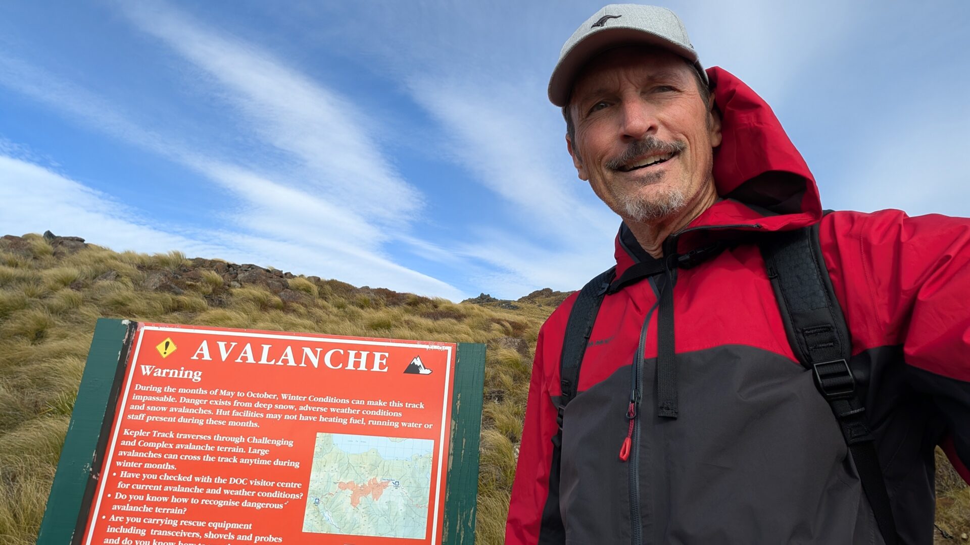
Winter (June–August): The Kepler Track is officially closed for through-hiking in winter, but the Brod Bay section is accessible with appropriate experience and gear. Snow on the ridge, ice on the exposed sections, dramatically reduced daylight, and the full weight of Fiordland’s winter atmosphere. Not for the underprepared.
Spring (September–November): Variable and often spectacular. Expect mud on the forest section, unpredictable ridge weather, and the fierce green that Fiordland produces after winter. One of the more photogenic seasons if the weather cooperates.
Common Mistakes to Avoid
- Starting too fast. The launch deposits you full of energy and surrounded by enthusiastic people. This is a trap. Find your pace in the first kilometre and defend it.
- Underestimating the ridge weather. It can be 18°C in Te Anau and actively unpleasant on the exposed Luxmore ridge. Pack layers regardless of what the morning forecast looks like.
- Not booking the launch. Driving to the Kepler Track Carpark and doing the lakeshore section adds time and flat kilometres. Not the end of the world — beautiful, in fact — but if you want the full mountain day, sort the boat first.
- Skipping the summit. Some people turn around at the hut. The summit is 15 minutes further. Do not skip the summit.
- Ignoring the return logistics. Check the launch schedule before you start. Discover it early rather than at Brod Bay with tired legs and a long afternoon ahead. Although — if the alternative is a lakeside walk in Fiordland, there are worse problems to have.
FAQs
How hard is Brod Bay to Mount Luxmore, really? Hard. That rating is honest. The elevation gain is 3,314 feet over about 6 miles to the summit — sustained, exposed in the upper section, and long enough that pacing matters enormously. Very fit hikers will cruise it; adequately prepared hikers will manage it; underprepared hikers will find it instructive.
Do I need to book the launch? Yes. The launch from Te Anau to Brod Bay is the most efficient access point for this route and it books out, especially in summer. Check Real Journeys (now Explore More) for current scheduling and availability. Do not leave this to the day before.
Can I do this as a day hike? Yes — this is a day hike. The full Kepler Track is a multi-day great walk but the Brod Bay to Luxmore section is entirely doable as a single day out. Budget 5–6 hours for the return trip including summit time.
What’s the lakeshore track back to Te Anau like? It’s a flat, well-formed 5.5km trail along the western shore of Lake Te Anau, passing through forest and open ground with continuous lake views. Lovely under normal circumstances. Quietly demanding after a full mountain day. Absolutely worth it if the alternative is sitting at a jetty for two hours doing nothing.
Is the Kepler Track suitable for beginners? The lakeshore section near Brod Bay, yes. The full Brod Bay to Luxmore climb, no — not without a reasonable base of hiking fitness. The distance, elevation, and ridge exposure put it firmly in the experienced day-hiker category.
What’s the view from Mount Luxmore actually like? Lake Te Anau, Lake Manapouri, the Murchison Mountains, the Kepler Range, and — on a very clear day — Fiordland rolling south toward the horizon. It is, by any fair measure, extraordinary. You will run out of superlatives. This is acceptable.
Conclusion: Pace Is Everything, and Everything Else Is Bonus
What the Brod Bay to Mount Luxmore hike teaches you, if you let it, is that long mountain days have their own internal logic and the only way to work with it is to stop fighting your own pace. The people who shot off that boat had energy I genuinely didn’t begrudge them — youth is a fine thing and should probably be spent running at mountains. But energy without rhythm is just enthusiasm, and enthusiasm alone doesn’t carry you 3,300 vertical feet and back.
Somewhere in the beech forest, around the second hour, something settles. The breathing finds its cadence. The legs find their agreement with the gradient. The mountain stops being a problem to be solved and becomes, instead, a thing you’re simply moving through. That’s when it gets good. That’s when 12.25 miles becomes not a test but an experience.
And if the boat isn’t there when you get back? Walk home along the lake. The views will carry you.
At 2,118 calories, 3,314 feet, and somewhere north of five total hours on your feet, you will arrive back in Te Anau with the particular kind of tiredness that feels entirely earned — the best kind there is.
Trail stats from a personal ascent. Launch timings subject to change — always verify before booking. Millennials remain unharmed and presumably reached the summit eventually.