Introduction
There’s a particular kind of surprise that comes from finding genuinely good hiking within commuting distance of a major American city. You’ve been conditioned to expect asphalt paths, aggressive cyclists, and lake views interrupted by condominiums, and then you turn a corner on a trail in Lake County, Illinois and find yourself looking through a canopy of mature trees at Lake Michigan stretching to a horizon that is, for all practical purposes, the ocean.
Fort Sheridan Loop Trail is that surprise. At 2.24 miles with 115 feet of elevation gain and a moving time of under an hour, it is not going to challenge your fitness in the way that a Kepler Track ascent or a Queenstown Hill climb will. What it is going to do is deliver a remarkably pleasant morning walk through a landscape that earns genuine attention: Lake Michigan blufftop views, wooded ravines, historic military architecture from the late 1800s, and the particular quality of early summer light on the water that makes you briefly forget you’re forty minutes from downtown Chicago.
The splits tell a small story, as they always do: mile one at 31:50, mile two at 22:42, the final 0.2 miles at 20:23. That first mile is the ravine section doing what ravine sections do — root-covered terrain, atmospheric shade, and scenery worth slowing down for. The pace found its rhythm from there, and the morning was well spent.
A Brief History Worth Knowing
Fort Sheridan is not just a trail — it’s a former U.S. Army post with a history that shapes what you’re walking through. Established in 1887 on land donated by Chicago business leaders following the Haymarket Affair, the fort operated as an active military installation for over a century before being decommissioned in 1993. The site was subsequently converted into a mixed residential community and preserved public land, with the Lake County Forest Preserves managing the natural areas and trails.
What this means for hikers is that the loop moves through a landscape combining restored native habitat — oak woodland, ravines, lakeshore bluffs — with the architectural legacy of a Victorian-era military post. A distinctive red-brick water tower and period brick buildings appear unexpectedly between the trees throughout the loop, adding a layer of history to what would already be a good walk on natural grounds alone.
Route Overview
- Distance: 2.24 miles (loop)
- Elevation Gain: 115 ft
- Moving Time: 59 minutes 25 seconds
- Total Time: 1 hour 6 minutes 40 seconds
- Average Pace: 26:31/mile
- Calories Burned: 515
- Difficulty: Easy to moderate
- Track Type: Loop
- Parking: Free, at the Fort Sheridan Forest Preserve trailhead
- Location: Fort Sheridan, Lake County, Illinois — approximately 25 miles north of Chicago
The loop combines several trail surfaces: wooded ravine path, blufftop trail with lake views, and sections through the historic grounds of the former fort. The 115 feet of elevation gain is modest in absolute terms but arrives in concentrated bursts — the ravine descent and ascent gives the first mile its character and earns the opening split with no apology required.
Trail Stages
Stage 1: The Ravine Section (Where the Pace Takes Its Time)
The opening section descends into one of the wooded ravines that characterise this stretch of the Lake Michigan shoreline — a deeply shaded corridor of mature trees, ferns, and lush understory that creates a tunnel effect even in midsummer. The ravines here are glacially formed, carved by meltwater after the last ice age, and they give the landscape a topographic interest that flat Illinois entirely lacks elsewhere.
Footing requires attention — roots, uneven terrain, soft shaded ground — which is exactly why mile one comes in at 31:50 and why that’s the right pace for it. The ravine is the most atmospherically distinct section of the loop: cool even in summer heat, quiet enough to hear the birds, and carrying the sound of the lake before the view arrives.
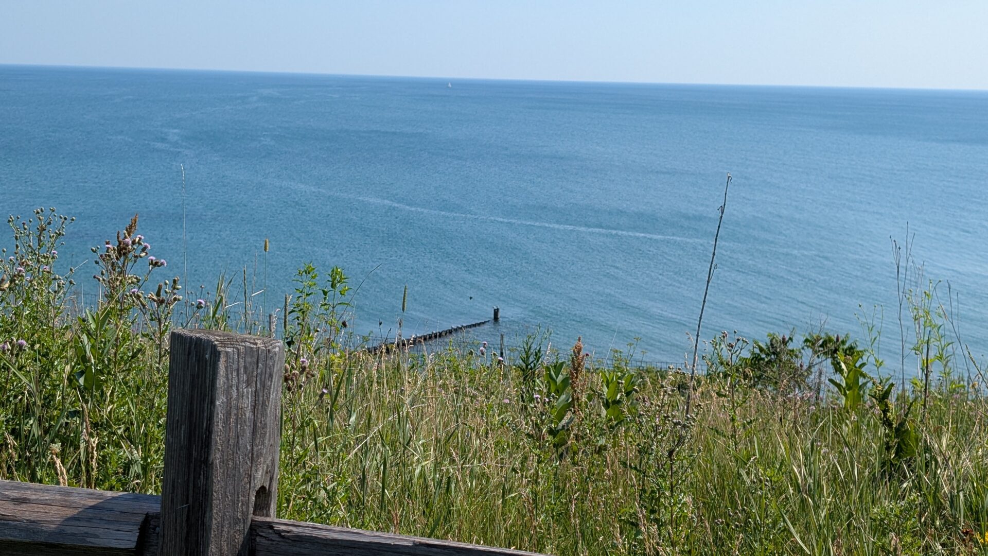
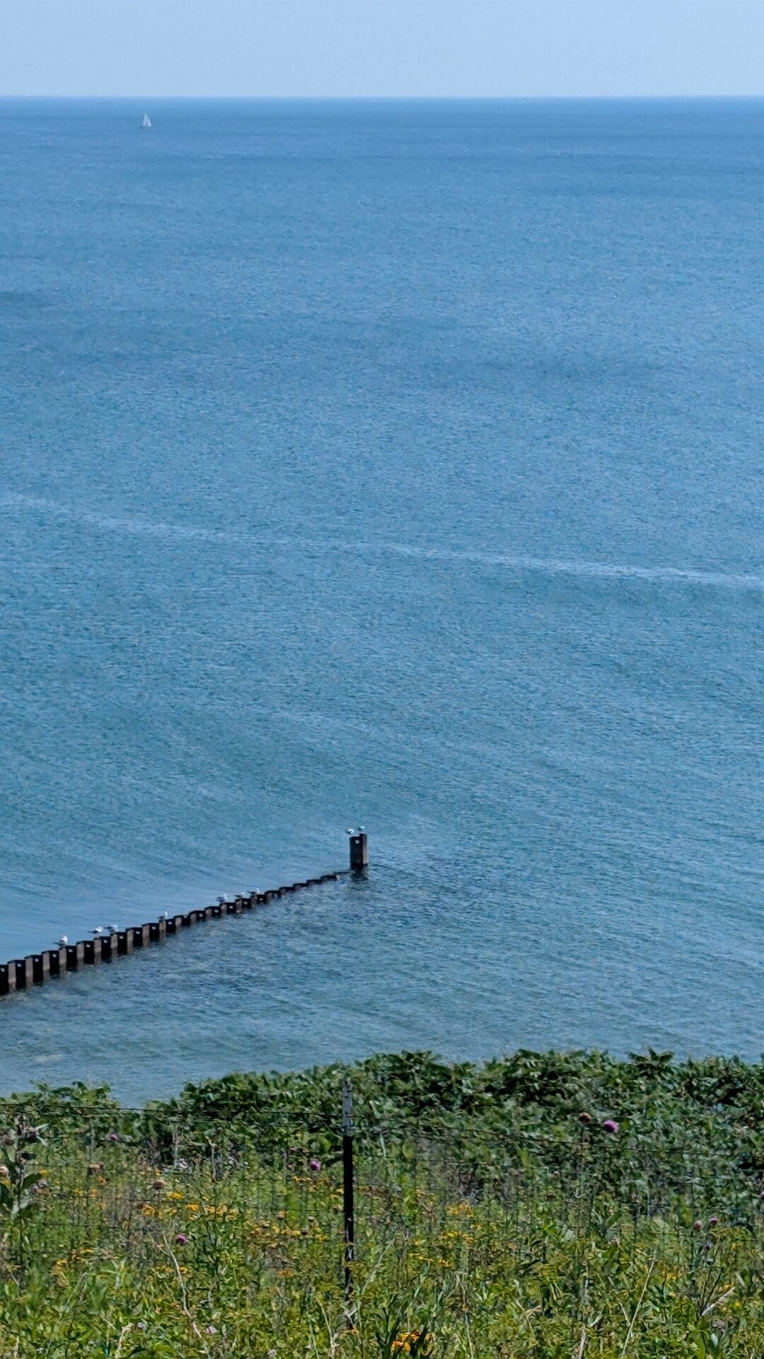
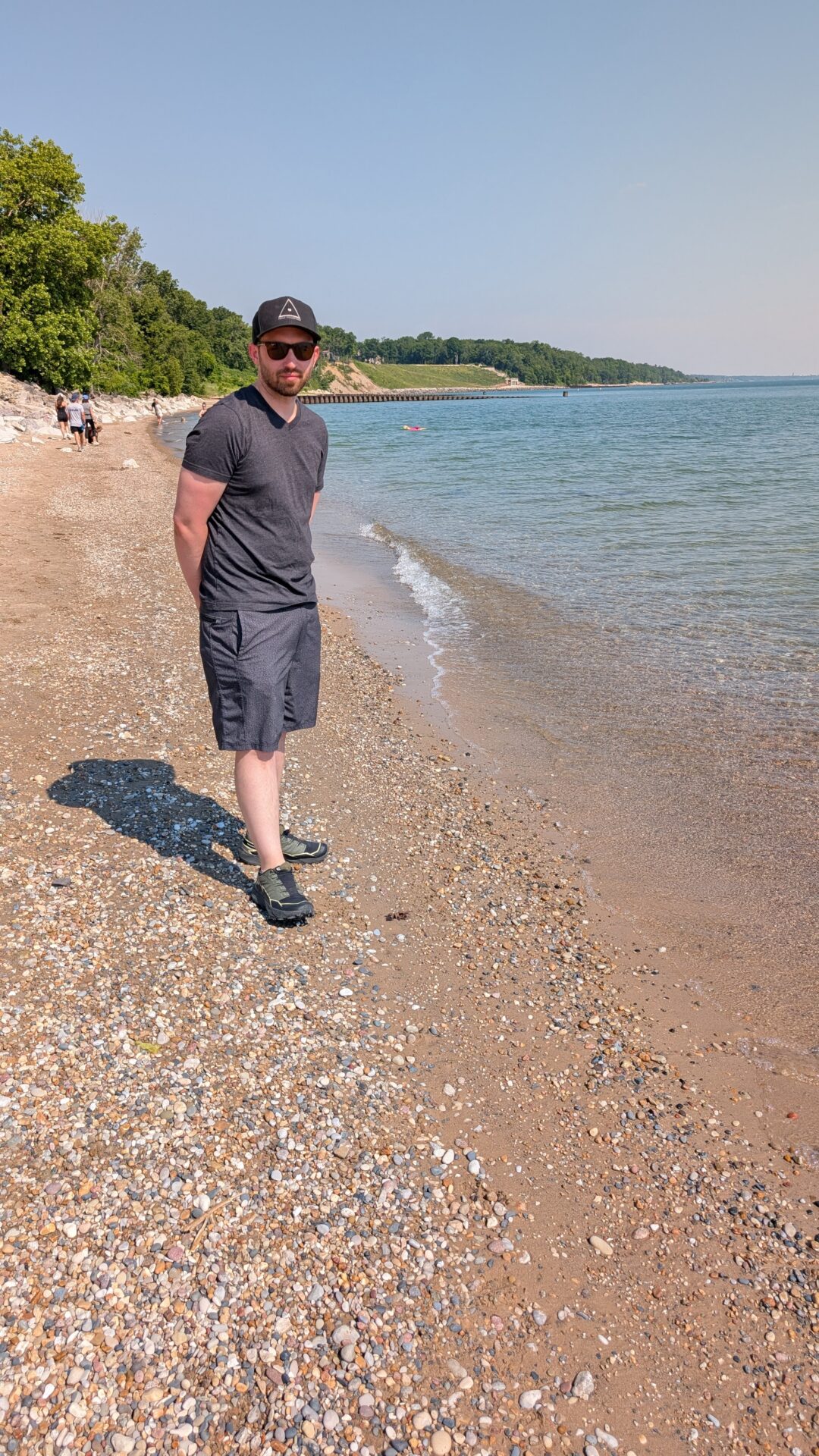
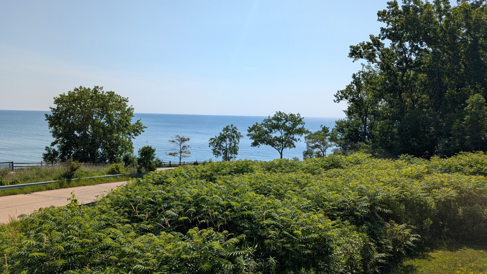
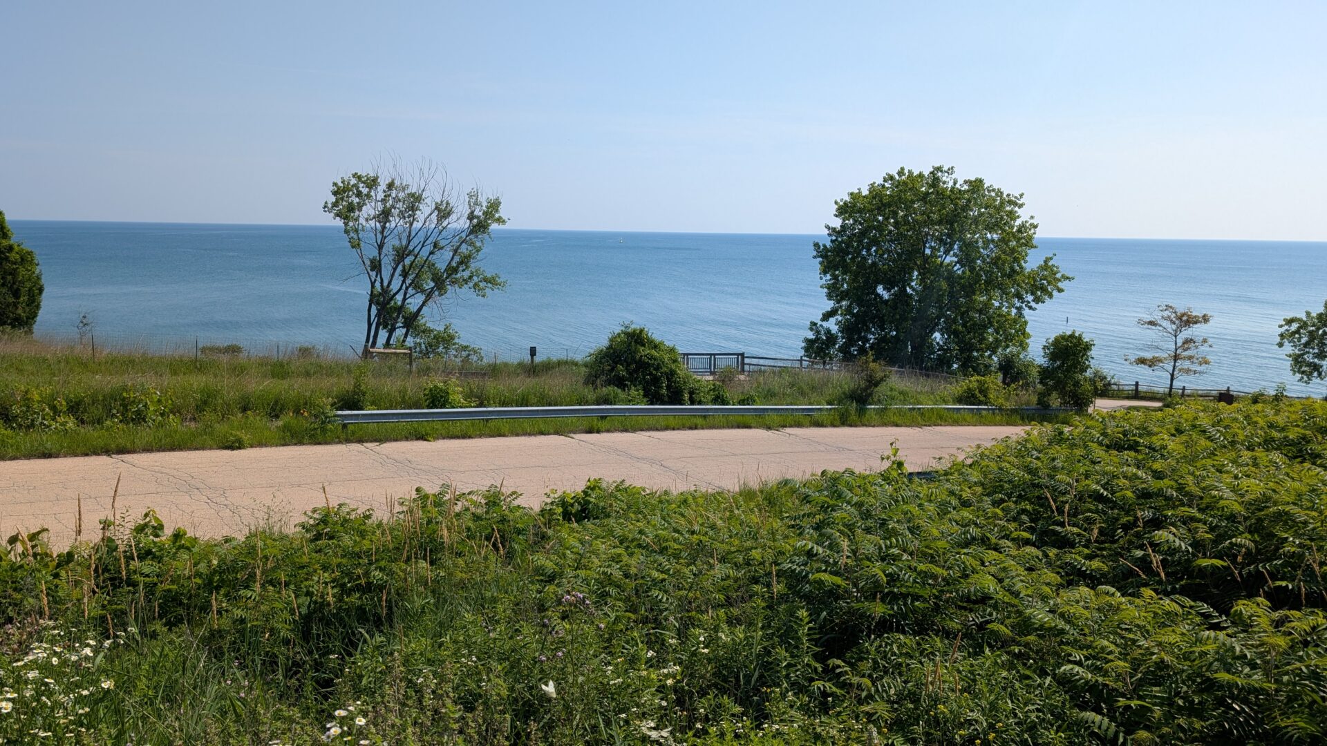
Stage 2: The Blufftop and Lake Michigan (The Reason You Came)
The trail climbs from the ravine and opens onto the Lake Michigan blufftop, and this is where the morning earns its keep. The lake appears through the trees with the flat, expansive quality it always carries from the Illinois shore — horizon to horizon, a blue that shifts with the sky, and that particular Great Lakes stillness that makes it feel more like a sea than a lake.
[Featured photo: Lake Michigan from the Fort Sheridan blufftop — the lake framed through mature summer trees, the water running flat and blue to the horizon under a clear morning sky. The green foreground is the ravine canopy below; the lake is the whole background.]
The blufftop path follows the shore with views that open and close as the canopy allows. Pace improves here — mile two at 22:42 — because the terrain flattens and the views pull you forward rather than requiring you to watch your feet. The historic water tower appears on the inland side periodically, the red brick incongruous among the oaks and thoroughly charming for it. There are unfenced sections at the bluff edge; walk with awareness.
Stage 3: The Historic Grounds and Return (Cooling Down Through History)
The final section passes through or beside the historic fort grounds — brick officers’ quarters, the edges of the parade ground, the architectural grammar of a late-nineteenth-century military post now repurposed as residential and public space. It is an unusual combination: hiking past what are now private homes on streets that were once part of a functioning army base. The scale and formality of the architecture give the whole section the feeling of passing through somewhere preserved rather than merely developed.
The final 0.2 miles at 20:23 reflects the flatter return terrain — legs fully warmed, elevation behind you, the loop closing back to the trailhead at a pace that feels like a comfortable finish rather than a slog.
What Makes This Trail Worth Your Morning
Fort Sheridan sits in a category that doesn’t get enough attention: the genuinely good urban-adjacent hike. Not a flat path around a retention pond that technically qualifies as a trail. Not a consolation prize for people who can’t get to real terrain. An actual loop through actual varied landscape with actual views, that rewards an early start with morning light on Lake Michigan and the quiet satisfaction of having done something worthwhile before the rest of the day begins.
The 515 calories burned across 2.24 miles reflects the ravine terrain — more physical output per mile than a flat lakefront path, less than a mountain ascent, and exactly right for a morning that leaves you feeling like the day started well rather than simply that you exercised.
What to Pack
For a sub-hour loop from a suburban trailhead, the list is genuinely short. But a few things earn their place:
- Water — more than you think for a summer morning. The ravine is humid and sheltered, and the blufftop in full sun gets warm.
- Insect repellent — the ravine section in summer is mosquito territory of the first order. Apply before you enter the trees, not at the first bite.
- Trail shoes or solid walking shoes — the ravine terrain and root-covered sections are uneven enough to make proper footwear worthwhile. Running shoes are adequate; sandals are a mistake.
- Sunscreen — the blufftop sections are exposed and summer UV is real even at this latitude.
- A light layer for early starts — the lake creates its own microclimate and early mornings on the blufftop can be notably cooler than conditions inland, particularly with a northeast breeze off the water.
Seasonal Considerations
Summer (June–August): The version in the photograph — full canopy, green and lush, the lake deep blue under summer haze. The ravine section is refreshingly cool. Go early to beat the heat on the exposed blufftop. Mosquito repellent is non-negotiable in the ravine.
Autumn (September–November): The best season, without qualification. The ravine trees turn in late October and the combination of autumn colour in the canopy below and late-season Lake Michigan blue above is quietly spectacular. The mosquitoes are gone, the crowds are thin, and the low-angle autumn light makes everything look better than it already is. Do this loop in October.
Winter (December–February): Cold, potentially icy on the blufftop where the lake wind is significant, and the ravine sections can be treacherous after ice. The lake in winter — steel grey, occasional ice along the shore, the horizon lost in low cloud — is beautiful in a stripped and unadorned way. Microspikes on the ravine sections after ice. Not casual walking conditions.
Spring (March–May): Soft ground, early wildflowers in the ravine, bare canopy giving longer views. The lake is at its most volatile in spring — dramatic wave action visible from the blufftop when the wind is up. Excellent birdwatching; the Lake Michigan shoreline is a major migratory corridor.
Common Mistakes to Avoid
- Arriving midday in summer. The blufftop in full afternoon sun with lake haze is the least interesting version of this walk. Morning light and a cooler lake breeze are both better.
- Skipping the ravine section. Some people treat the first mile as the getting-there section. It is the section. The old-growth character of the ravine trees and the glacial topography are worth the slower pace.
- No insect repellent in summer. This cannot be overstated for the ravine. You will regret it within thirty seconds of entering the trees.
- Wearing sandals. The ravine roots and uneven terrain make this an active choice to have a worse experience. Wear something properly connected to your foot.
- Treating the bluff edge as an implied fence. It is not fenced. The lake is a long way below. Walk with appropriate attention.
FAQs
Where do I park for the Fort Sheridan Loop Trail? The Lake County Forest Preserves maintains a free trailhead parking area. Access is from the Fort Sheridan area off Sheridan Road in Lake Forest/Lake County. Check the Lake County Forest Preserves website for current access details and any seasonal closures before driving out.
Is this trail suitable for children? The blufftop and historic grounds sections work well for most children. The ravine section with its uneven terrain requires more attention with smaller kids. The unfenced bluff edge sections need active supervision. It’s a manageable family walk with appropriate expectations.
How does Fort Sheridan compare to other North Shore trails? It’s one of the more varied short loops in the area — the combination of ravine, blufftop, and historic grounds gives it more character than purely lakeshore or purely woodland alternatives. Illinois Beach State Park offers more open shoreline access; the Des Plaines River Trail offers longer distance. Fort Sheridan is the pick for a compact, varied, historically interesting morning loop.
Can you actually see Lake Michigan from the trail? Yes — the blufftop section has consistent lake views through the canopy, with several points where the view opens more fully. Morning light off the water is the specific reward for an early start.
Is the loop well-marked? Generally yes. A downloaded trail map from the Lake County Forest Preserves website is useful for first-time visitors, particularly for the sections that pass through the historic grounds where the trail routing is less intuitive.
Conclusion: The Commuter Belt Hike That Punches Above Its Weight
Fort Sheridan Loop Trail doesn’t ask you to adjust your expectations downward. It doesn’t apologise for being suburban. It doesn’t require you to squint past the infrastructure to find the landscape. It simply delivers — a wooded ravine, a blufftop, Lake Michigan in morning light, and 115 feet of elevation across 2.24 miles — in under an hour from a free car park forty minutes from the Loop.
At 515 calories, with a first mile that asks you to slow down for the terrain, and a lake view that opens exactly when you need it to, this is the kind of trail that makes an early Tuesday feel like something that mattered. Not every hike needs to be a mountain. Some of the best ones are right there in the commuter belt, doing their quiet, underrated work, waiting for the people who show up before 8am and actually look around.
Be one of those people.
Trail stats from a personal morning loop. Conditions: clear summer morning, light lake haze. Lake Michigan: present and large. Ravine mosquitoes: also present and large. First mile pace: entirely justified by the terrain.