Introduction
The Grand Canyon Track Blue Mountains walk is the reason most visitors make the trip out here in the first place. The Blue Mountains rise about ninety minutes west of Sydney, and the first thing you should know about them is that they are not, in fact, blue-black basalt drama or anything resembling the American Rockies. They are a sandstone plateau, cut into deep, tree-choked gorges by millions of years of erosion, and named for the haze of eucalyptus oil that hangs over the whole range on a hot day and genuinely does turn the ridgelines a soft, improbable blue from a distance. It is one of the more reliably beautiful optical tricks in Australian geography, and it works exactly as advertised from every lookout in the park.
The Grand Canyon Track, which starts near Blackheath and despite the name has nothing to do with Arizona, is the walk that convinces people the Blue Mountains deserve their reputation. It drops from the plateau into a narrow, fern-choked slot gorge, follows a creek past waterfalls and under sandstone overhangs you can walk beneath, and climbs back out to a lookout with a view that makes the whole descent feel like it happened somewhere else entirely.
It is a loop, it is manageable in half a day, and it is, unusually for a “canyon” walk in a country not exactly short on very large actual canyons, genuinely one of the best short bushwalks in New South Wales.
The Landscape: What You’re Actually In
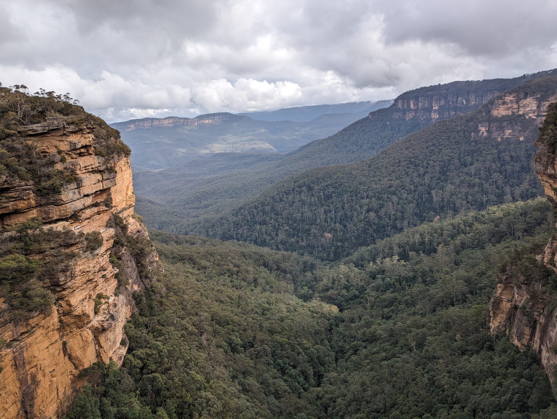
The Blue Mountains aren’t mountains in the range-and-peak sense — they’re a heavily eroded sandstone plateau, split by deep gorges where creeks have spent an extraordinary amount of time cutting down through soft rock. The result is a landscape of clifflines, hanging valleys, and slot-like canyons that feel, at ground level in the gorge, completely disconnected from the flat, dry tableland just a few hundred metres above.
The Grand Canyon Track specifically threads through cool temperate rainforest in the gorge bottom — coachwood, sassafras, tree ferns, the works — a genuinely different ecosystem from the dry eucalypt forest on the plateau rim above it. The transition happens within a few hundred metres of descent, and it’s one of the more effective demonstrations of how much microclimate a sandstone gorge can generate.
The Hike: Down Into the Gorge and Back Out
Neates Glen: The Descent
The track begins at Neates Glen, a short drive from Blackheath township, and drops immediately and steeply via a set of stone steps into the gorge. Within minutes the eucalypt forest gives way to rainforest, the temperature drops, and the light goes green-filtered and dim in the way that only a genuinely dense fern canopy can manage at eleven in the morning.
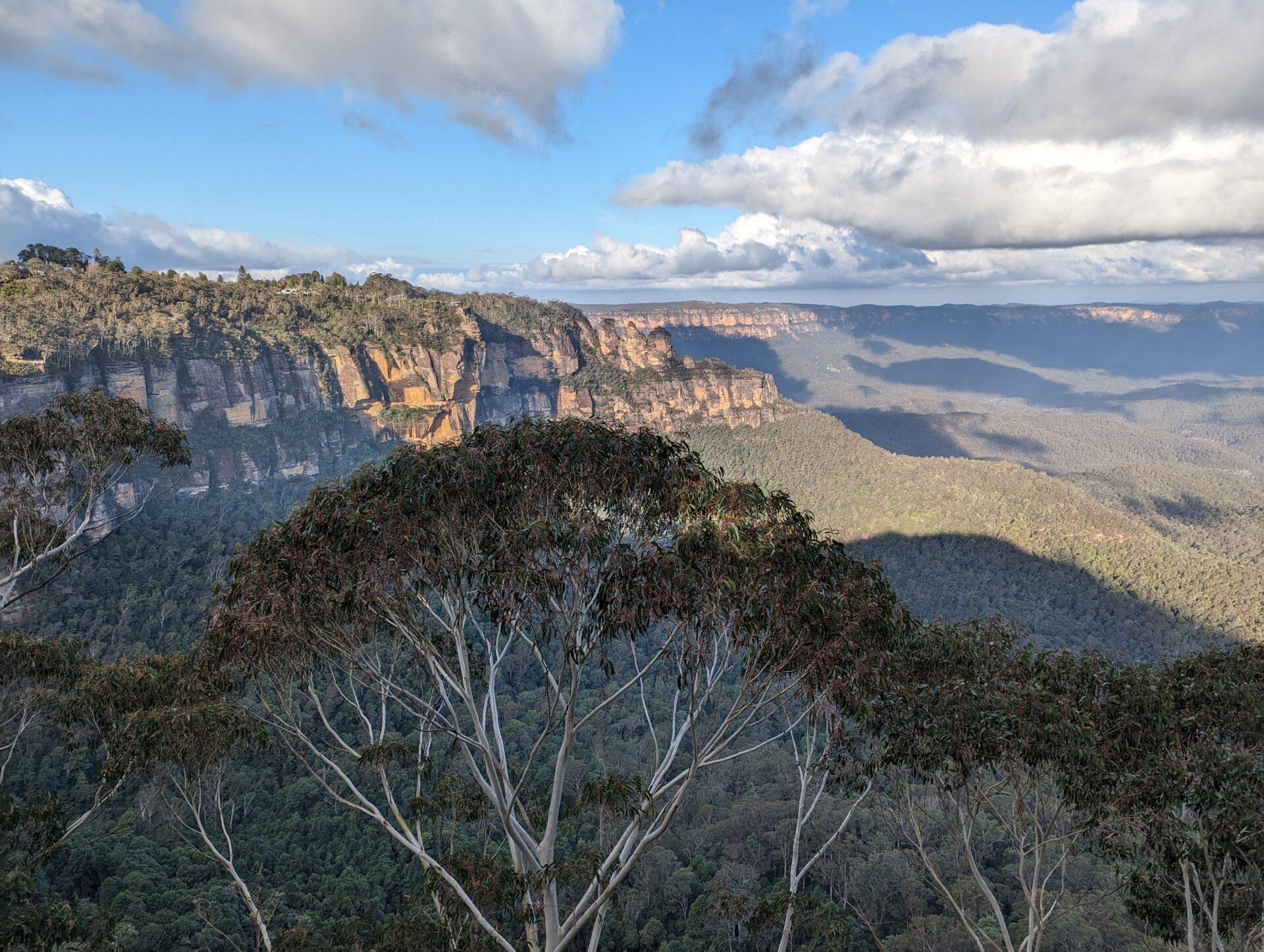
[Featured photo: Looking down into the gorge from the clifftop lookout near the start of the track — layers of blue-hazed ridgelines receding into the distance, the kind of view that explains the name of the whole mountain range.]
The Gorge Floor: Waterfalls and Overhangs
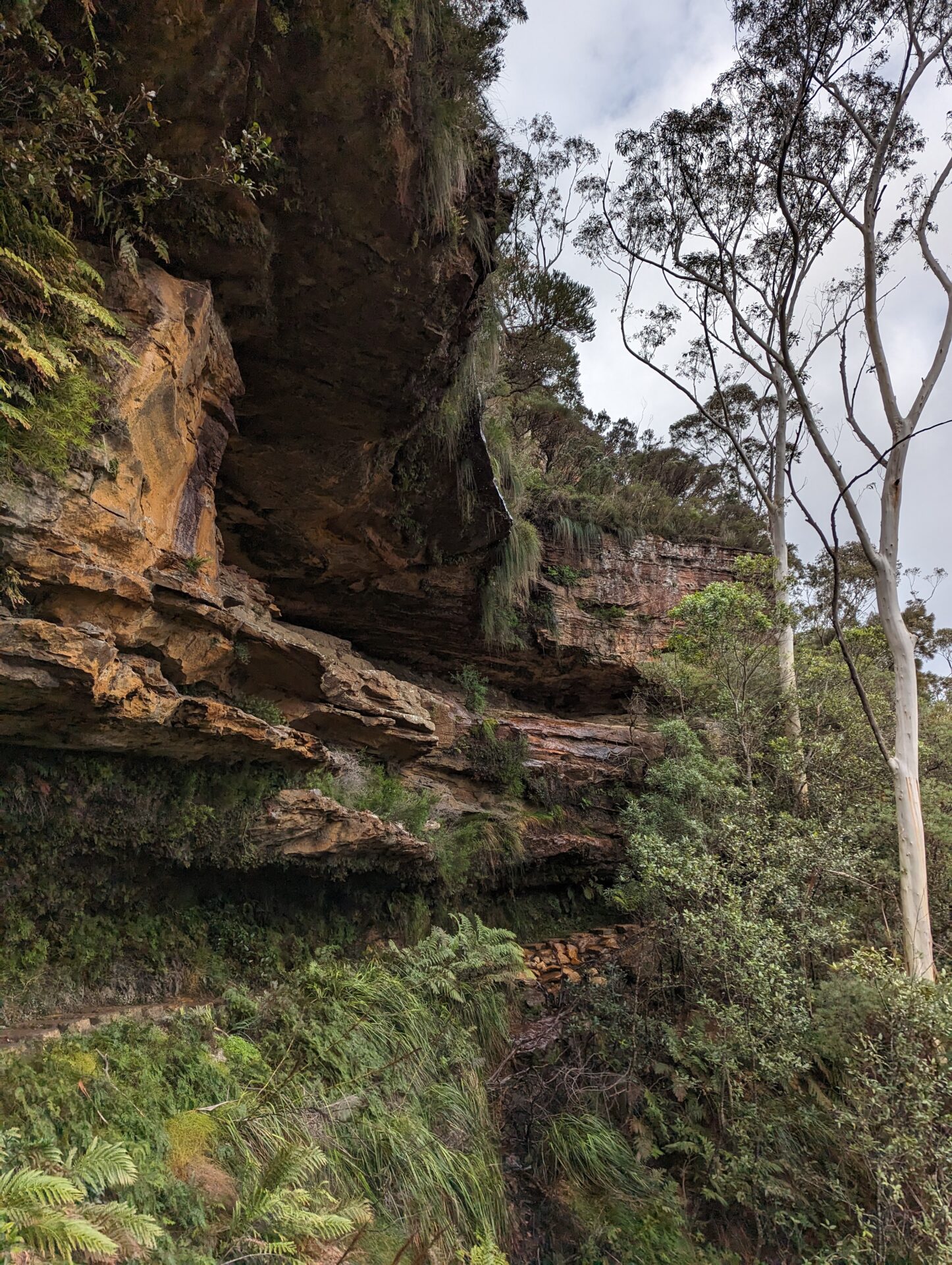
From Neates Glen the track follows Greaves Creek downstream, and this is the section that does the heavy lifting for the “Grand Canyon” name. The path ducks under sandstone overhangs undercut by centuries of water, past a series of small cascades and one genuinely photogenic waterfall where the creek drops over a mossy lip into a fern-ringed pool. The rock here has been carved into smooth, curved chambers that trap the light and the sound of running water in a way that makes the whole gorge feel more like a cathedral than a hiking trail.
[Featured photo: The waterfall along Greaves Creek, water sheeting over dark rock into a pool ringed with tree ferns.]
The track is well-formed but narrow in places, with boardwalks and steps carrying you across the wetter sections. Budget extra time here regardless of fitness level — not because it’s hard, but because everyone stops to take the same photo you’re about to take.
Evans Lookout: The Climb Out
Eventually the track turns away from the creek and starts climbing, and this is the one genuinely strenuous stretch of the loop: a steady, switchbacking ascent back up the sandstone cliff line to Evans Lookout. It’s not technical, but it is a real climb after a couple of relatively flat hours, and the transition from rainforest gully back to dry eucalypt woodland happens fast enough that you’ll notice the change in temperature within a few minutes.
The payoff is Evans Lookout itself, a clifftop platform looking back out over the Grose Valley — layered sandstone escarpments fading into that trademark blue haze, with the gorge you just walked through hidden somewhere in the green far below. It’s a fitting bookend, and a good excuse to sit down for ten minutes before the short road walk back to the car park at Neates Glen.
Practical Details
- Distance: About 5.5 km return as a loop (Neates Glen to Evans Lookout and back), roughly 3–4 hours at an unhurried pace with photo stops.
- Elevation: Around 300 m of descent and re-ascent — most of it concentrated in the initial drop from Neates Glen and the climb out to Evans Lookout.
- Difficulty: Moderate. Well-maintained track with stairs, boardwalks, and one sustained climb; not technical, but not a flat stroll either.
- Getting there: Neates Glen car park is a short drive from Blackheath, about 90 minutes west of Sydney via the Great Western Highway.
- Best time: Year-round, though the gorge can be genuinely cold and slippery in winter. Weekday mornings avoid the worst of the crowds, especially in the Greaves Creek section.
- Facilities: Toilets and parking at Neates Glen; cafés and pubs back in Blackheath township for the debrief.
Common Mistakes
The most common one is underestimating the climb out. The descent from Neates Glen is easy enough that people set an ambitious pace, then find the ascent to Evans Lookout harder than expected because they’ve already spent their legs. Treat the loop as back-loaded, not front-loaded.
The second is footwear. The gorge floor stays damp and mossy even in dry weather, and the boardwalk sections get slick. Grippy shoes matter more here than the “moderate” difficulty rating suggests.
The third is assuming a two-car shuttle saves time. Neates Glen and Evans Lookout car parks are a short but real drive apart by road, not a five-minute walk. Most people just do the loop back on foot, and honestly that’s the easier option.
FAQs
Is the Grand Canyon Track suitable for kids?
Yes, for reasonably fit kids used to a few hours of walking. The stairs and the climb out are the main considerations — it’s not a pram-friendly track, and younger children may need a slow, patient pace on the ascent.
Do I need to book or pay to walk it?
No permit or booking is required. Parking at Neates Glen can fill up on weekends, so an early start helps.
Can I extend the walk?
Yes — the track connects into the broader Blue Mountains track network around Blackheath, and it’s possible to link it with other nearby walks for a longer day. As a standalone loop, though, it’s a well-contained half-day outing.
Conclusion
The Grand Canyon Track earns its name through misdirection more than accuracy — there’s no red rock or mile-deep chasm, just a quietly spectacular sandstone gorge doing a very good impression of somewhere else entirely. For a half-day’s effort and a 90-minute drive from Sydney, it delivers rainforest, waterfalls, and one of the best lookouts in the Blue Mountains without asking for a multi-day commitment.
Related hikes: if you enjoyed this, check out our Indiana Dunes and Bryce Canyon write-ups for more short, high-payoff trails.
Distance: 5.5 km | Difficulty: Moderate | Time: 3–4 hours