Introduction
Let’s be upfront about something: I did not waltz up Queenstown Hill in a linen shirt looking effortlessly windswept. There was huffing. There was a brief philosophical crisis somewhere around the 800-foot elevation mark. And there was definitely a moment where I sat on a rock and pretended to admire the view while actually just trying to remember how to breathe.
But here’s the thing — Queenstown Hill Walkway is one of those trails that earns its reputation the hard way, by making you work for every single one of its rewards, then delivering those rewards so spectacularly that you immediately forgive the whole ordeal. At 3.22 miles with 1,214 feet of elevation gain, this is not a stroll. It is, however, one of the best ways to spend 66-odd minutes in New Zealand’s adventure capital — and that is saying something in a town where you can literally fling yourself off a bridge for fun.
So if you’re weighing up whether Queenstown Hill is worth it, allow me — a reasonably fit, occasionally dramatic, entirely sincere hiker — to walk you through it. Pun very much intended.
Route Overview
- Distance: 3.22 miles (return)
- Elevation Gain: 1,214 ft
- Moving Time: ~1 hour 5 minutes (ambitious), ~1 hour 6 minutes total (realistic)
- Average Pace: 20:18/mile
- Calories Burned: ~568
- Difficulty: Hard
- Trail Type: Out-and-back
- Conditions: Great
- Views: Also great (understatement of the Southern Hemisphere)
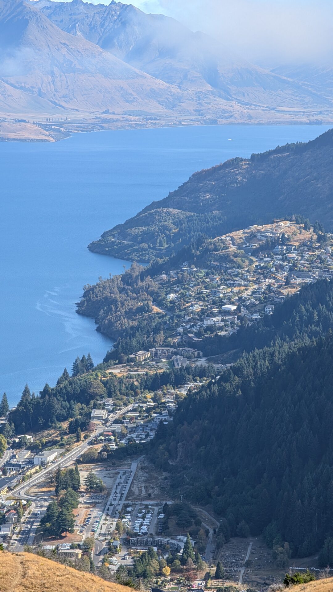
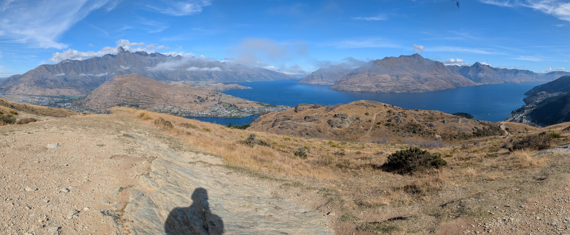
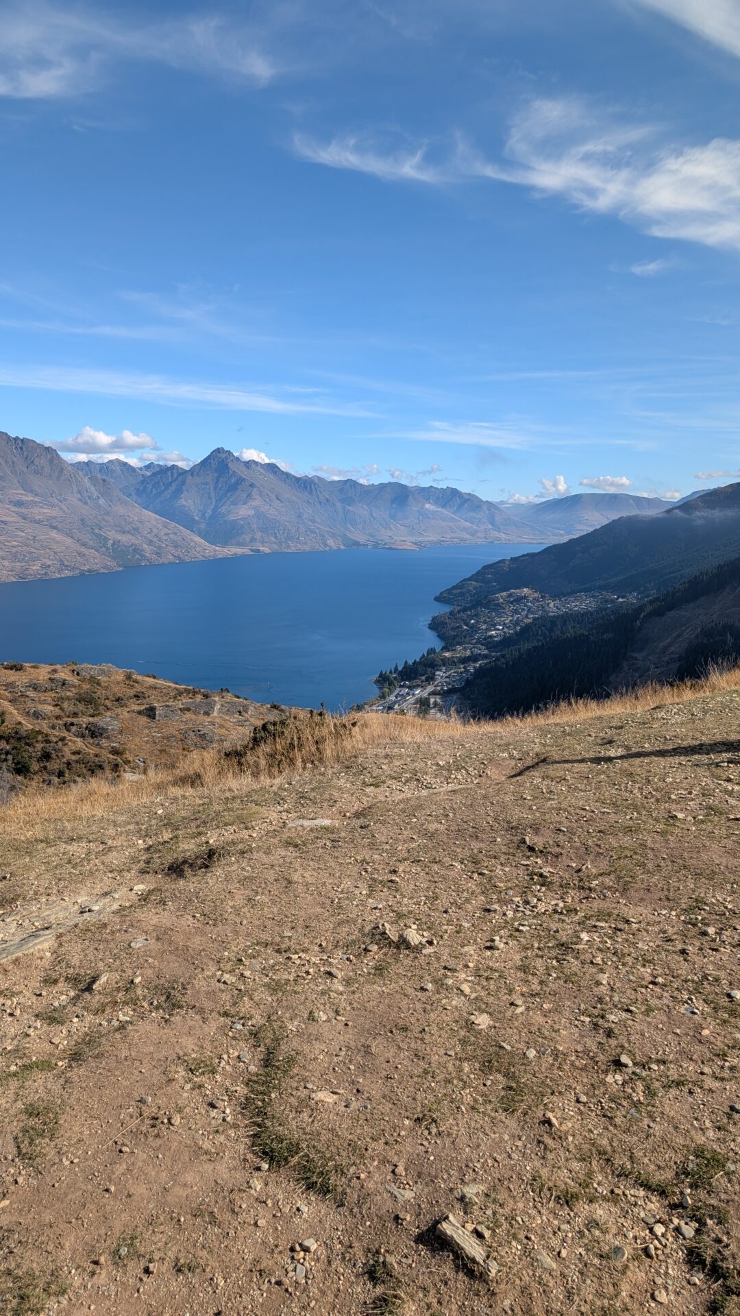
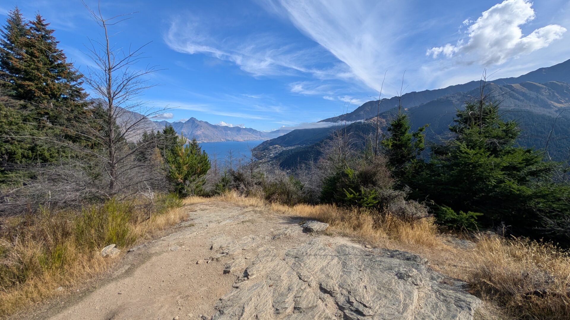
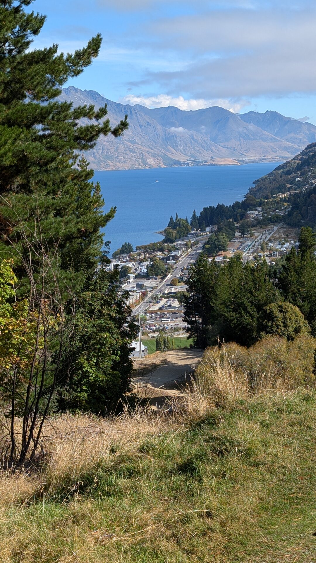
The Queenstown Hill Walkway starts at the top of Belfast Street, a quiet residential area that gives zero indication of what you’re about to put your legs through. The trail winds up through pine forest before breaking out into open tussock grassland, and then — assuming your quads haven’t staged a formal protest — delivers you to the summit basket at roughly 1,788 feet above sea level, with a panoramic view that includes Lake Wakatipu, the Remarkables, Cecil Peak, and the town of Queenstown laid out below you like a postcard someone rendered in high definition.
The return is the same path back. Which is either reassuring or devastating, depending on how much you’re dreading the descent on tired knees.
Trail Stages: A Moderately Honest Breakdown
Stage 1: The Forest Section (False Security Zone)
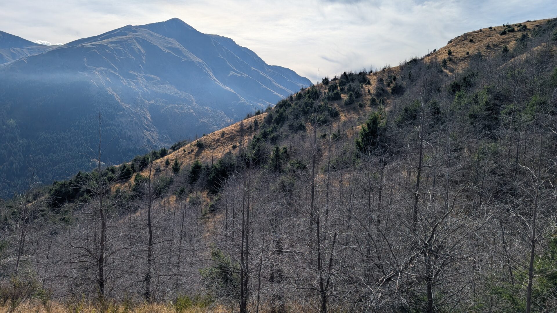
The first stretch is shaded, pine-scented, and deceptively forgiving. The gradient is manageable, the track is well-maintained, and you’ll probably pass the time thinking things like, “This isn’t so bad,” and, “I should do this every morning.” Enjoy this feeling. It will not last.
The path switchbacks through the trees, gaining elevation steadily. There’s nothing technically challenging here — just consistent uphill movement that slowly convinces your cardiovascular system this is now your life.
Stage 2: The Tussock Switchbacks (Where Opinions Change)
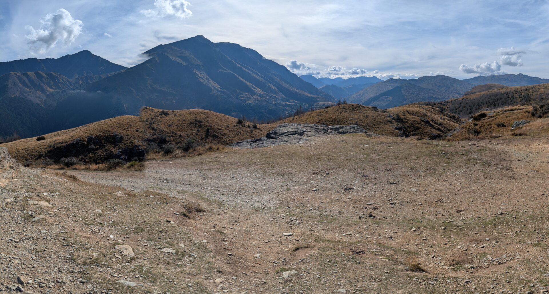
Once the forest thins and you emerge into open grassland, two things happen simultaneously: the views become genuinely jaw-dropping, and the trail becomes noticeably more direct about its intentions. The switchbacks up the open slope are exposed — which means wind, which means sunshine, which means you are no longer shielded from the reality of what you’ve signed up for.
This is also where the 1,214-foot elevation gain makes itself felt in your actual body. The pace tends to slow here. The rest breaks become more frequent and better-justified. “I’m stopping to look at the view” becomes both true and conveniently timed.
Stage 3: The Fairy Garden Detour (Yes, Really) and Summit Push
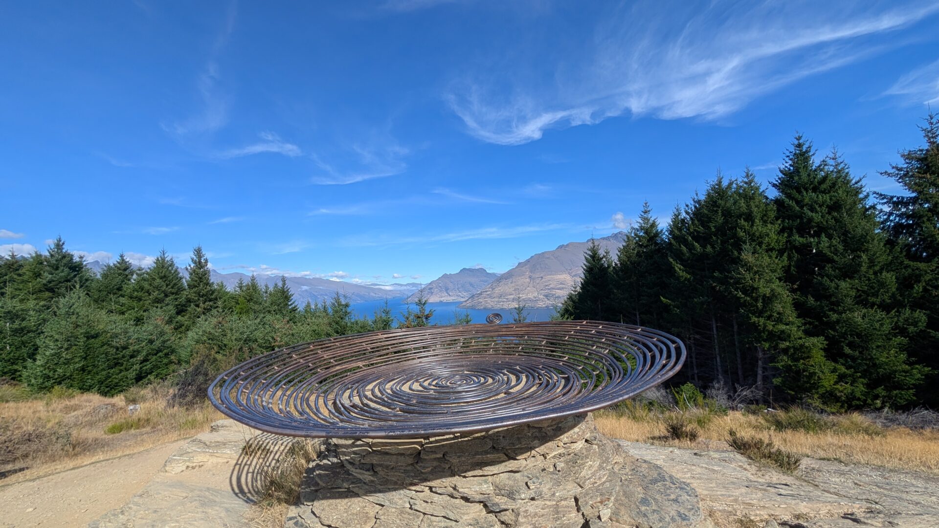
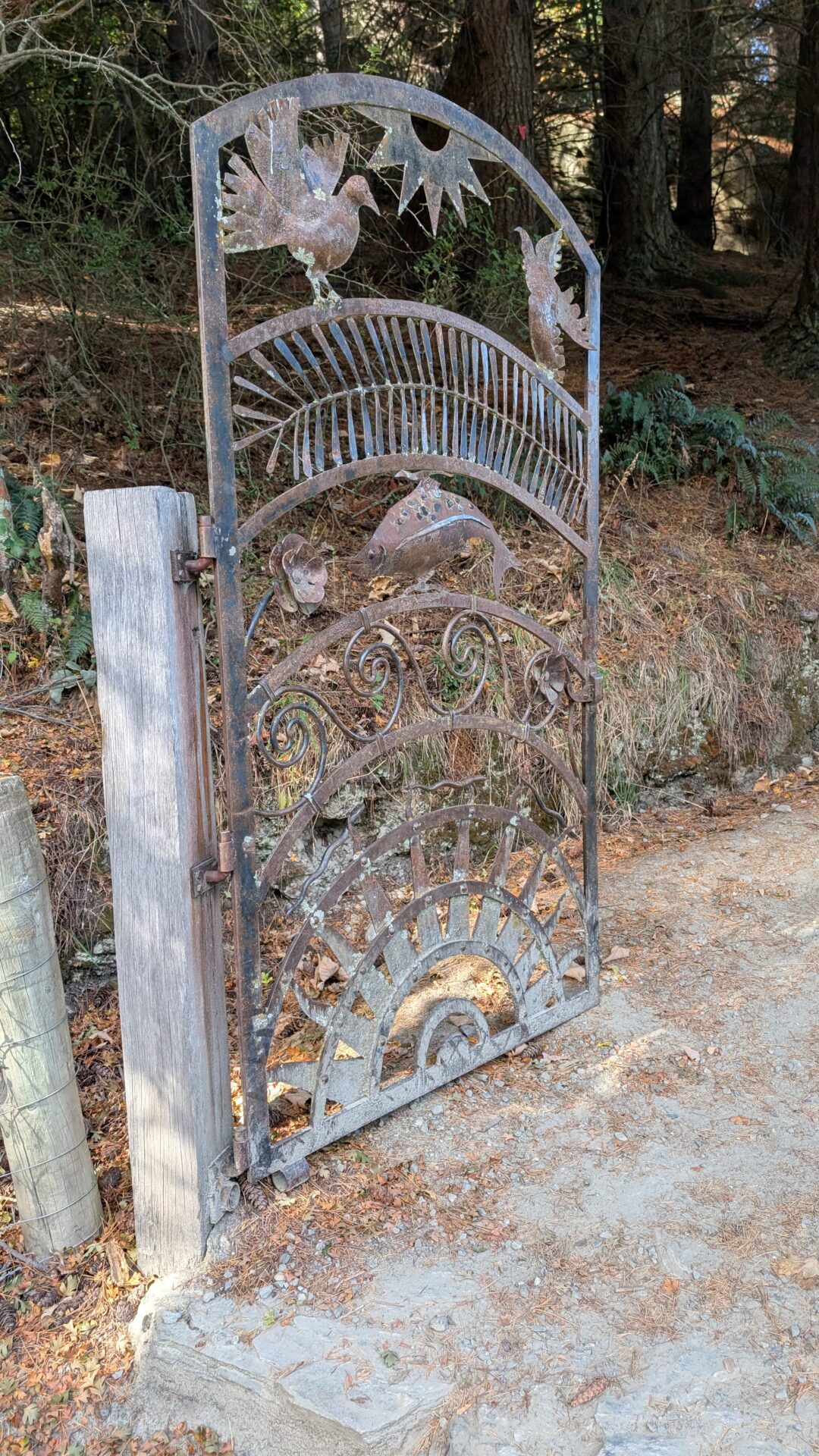
Before the final push to the top, the trail passes something that will either make you stop in genuine delight or make you question your life choices: the fairy garden. Tucked into a cluster of trees near the upper section, this is a community-built collection of miniature fairy doors, tiny handmade houses, and small whimsical installations nestled into the roots and bark of the surrounding trees. It is, objectively speaking, adorable. It is also extremely funny to encounter when you’re breathing hard and your thighs are staging industrial action.
No one warned me about the fairy garden. One moment I was grimly counting switchbacks; the next I was crouching beside a two-inch wooden door with a brass knocker wondering if the fairies had better views than I did. Spoiler: they did not. But they had better real estate.
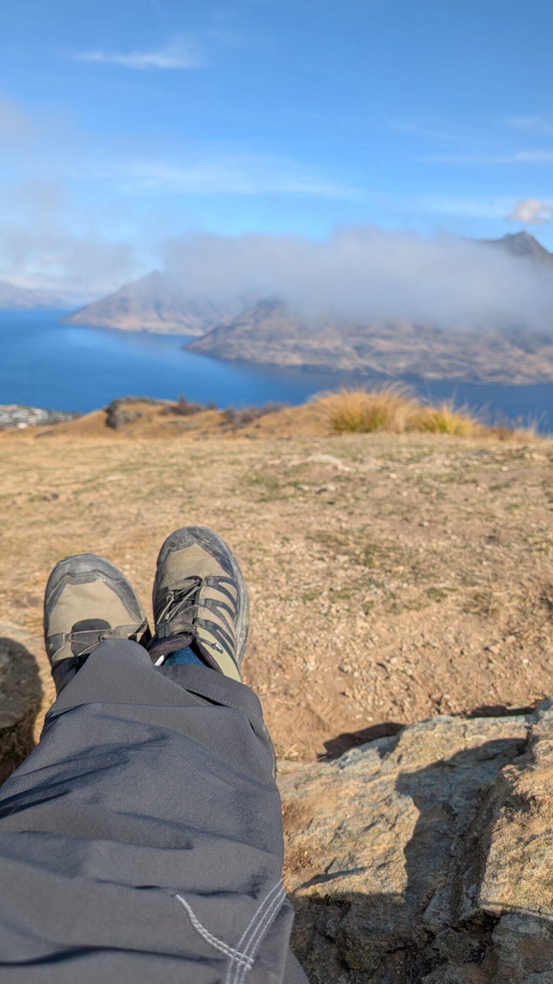
Take a minute here. Let kids (and adults who’ve successfully retained their sense of whimsy) inspect the installations. It’s a genuinely charming community effort and a legitimately good excuse to catch your breath before the final climb — which you will need, because the trail doesn’t get easier just because you’ve briefly communed with imaginary woodland residents.
The final approach to the summit basket is steep enough to require your full attention but short enough that quitting at this stage would be genuinely embarrassing. You can see the top. You can also see other people who have already reached it, looking relaxed and smug in the way only summit-achievers can.
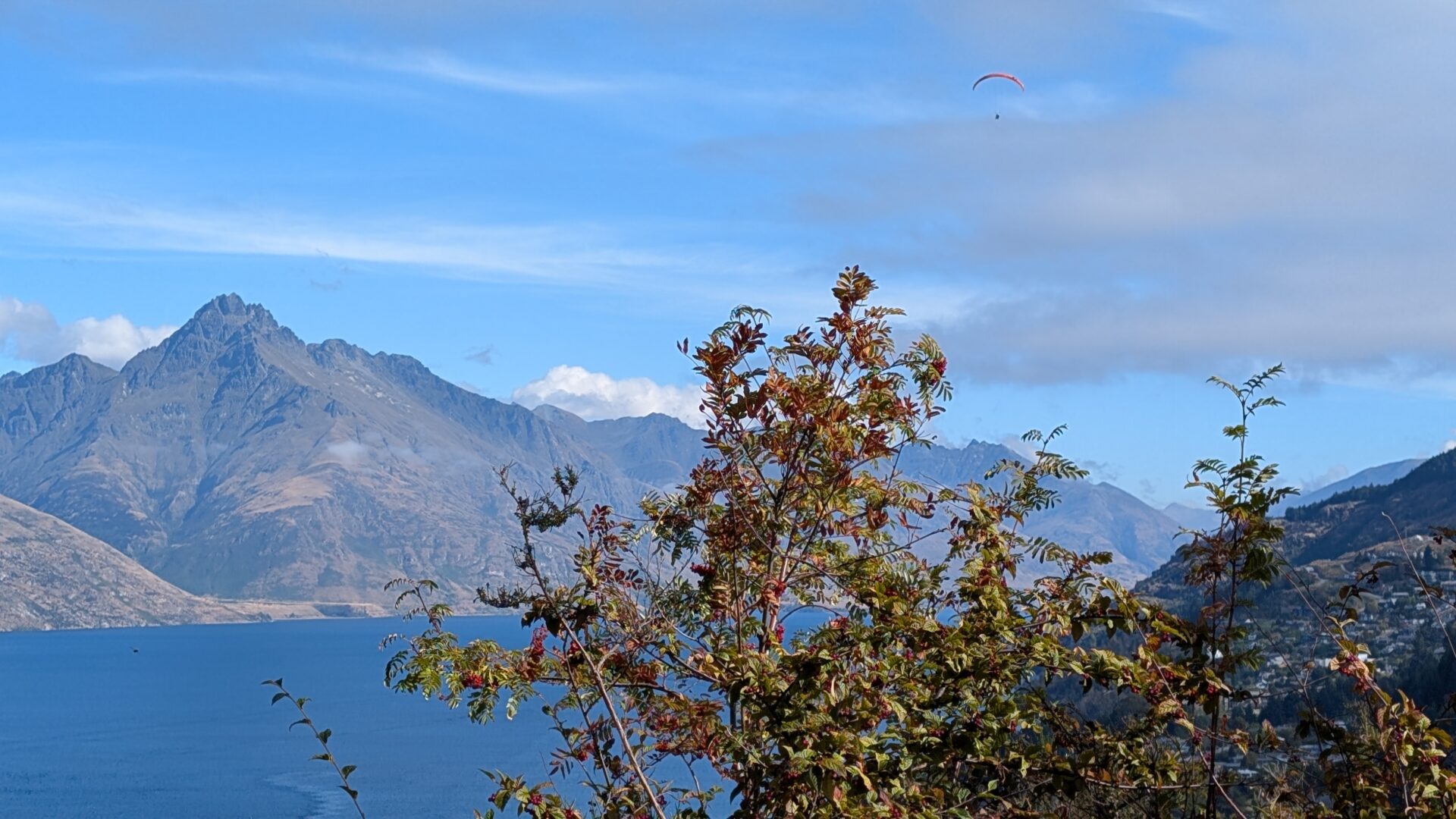
Push through. The view from the top — of Lake Wakatipu stretching toward Kingston, of the Remarkables looming with their frankly theatrical presence, of tiny Queenstown below — is the kind of thing that makes you momentarily forget your legs exist and just stand there like a person in a tourism ad, grinning at nothing.
What to Pack (And What to Leave Behind)
Bring:
- Water — at least 500ml, ideally a litre. The trail is exposed and dry, and dehydration is embarrassing.
- Sunscreen — the open tussock section will cook you if you let it.
- Layers — Queenstown weather changes moods faster than a group chat. A lightweight windproof jacket takes up no space and earns its keep at the summit.
- Decent footwear — trail runners or hiking shoes. The path is well-groomed but not a footpath. Flip-flops are not a personality, they are a liability.
- Snacks — something small and calorie-dense. You’re burning 568 calories. Replace some of them.
- Phone/Camera — obviously. The views are summit-of-your-Instagram-game material.
Leave Behind:
- The assumption that “hard” means technical. It means sustained elevation. Pace yourself accordingly.
- Your heavy daypack unless you’re planning to bivouac at the top, which would be odd but impressive.
Seasonal Considerations
Summer (December–February): Ideal conditions, long days, warm temperatures. Start early to beat the midday heat on the exposed upper section. The trail is popular — if you want contemplative solitude, 7am is your friend.
Autumn (March–May): Possibly the best season. The light is golden, the crowds are thinner, and the temperatures are reasonable. The tussock takes on warmer tones. Highly recommended.
Winter (June–August): Cold, potentially icy on higher sections, and the days are short. That said, snow on the Remarkables as your backdrop is absolutely cinematic. Check conditions before going. Bring traction devices if there’s ice. Don’t be the person who falls dramatically on a frozen trail.
Spring (September–November): Variable but generally lovely. Some muddy patches early in the season. The upside: wildflowers, fresh air, and the smug satisfaction of hiking while everyone else is still in hibernation mode.
Common Mistakes to Avoid
- Underestimating the climb. It looks approachable on paper. “1,214 feet” is abstract until you’re living it. Adjust your expectations and your timeline before you start.
- Starting too late in the day. The exposed upper section is unpleasant in harsh afternoon sun in summer. Get there before 10am or after 4pm.
- Wearing cotton. It soaks through, stays wet, and makes the summit wind miserable. Synthetic or merino for the win.
- Ignoring the descent. Knees, ankles, and attention spans all flag on the way down. Trekking poles are genuinely useful here and not at all uncool, regardless of what your ego tells you.
- Not pausing on the way up. The views build incrementally and are worth appreciating in real time. The whole point isn’t just the summit — it’s the access to altitude.
FAQs
How long does Queenstown Hill Walkway actually take? Budget 1.5 to 2 hours for a comfortable return trip, including summit time. The moving time clocks in around 65 minutes if you’re reasonably fit and don’t dawdle. Add 20–30 minutes for the dawdling, because you will dawdle. The views demand it.
Is Queenstown Hill suitable for beginners? It’s rated hard — mainly because of the sustained elevation gain — but it doesn’t require any technical skill. If you’re a reasonably active person who can manage an hour of uphill movement, you’ll be fine. Just don’t bill it to yourself as a warm-up.
Can I bring my dog? Yes, dogs are welcome on the trail. Keep them on a lead where signposted and, please, clean up after them. The views are spectacular; what’s on the ground shouldn’t be.
Is there parking at the trailhead? Limited street parking on Belfast Street. Queenstown is a town that loves its visitors but was not designed for them to all drive simultaneously. Consider walking from town (adds pleasant context) or checking local parking ahead of time.
What are the views actually like? Lake Wakatipu. The Remarkables. Cecil Peak. Walter Peak. Queenstown below. It’s the kind of panorama that makes you want to stay up there until the light changes, and then stay a bit longer, and then realize you’re going to have to descend in the dark and you didn’t bring a headlamp.
What’s the fairy garden on Queenstown Hill? A community-built collection of miniature fairy doors, tiny houses, and handmade woodland installations tucked into the trees near the upper section of the trail. It’s charming, it’s unexpected, and it will absolutely make you stop walking so you can crouch down and peer at a door the size of your palm. There’s no formal signage for it — you’ll simply round a corner and suddenly understand why people keep coming back to this trail even after their knees have strongly requested otherwise.
Is the trail well-marked? Yes. It’s clear, well-maintained, and signposted. You’d have to be genuinely trying to get lost.
Conclusion: Hard, Honest, and Absolutely Worth It
Here’s what Queenstown Hill Walkway is, at its core: it’s the kind of hike that doesn’t flatter you while you’re doing it but gives you something real when it’s done. Not just the views — though those are legitimately spectacular and deserve every cliché they attract — but the particular satisfaction of having earned your elevation gain one honest footfall at a time.
At 568 calories, 1,214 feet, and just over an hour of actual movement, it’s not the hardest thing you’ll ever do. It’s not supposed to be. It’s supposed to remind you what your body can do when you stop asking it to stay horizontal and start asking it to go somewhere interesting.
Queenstown will happily sell you a bungee jump, a jet boat ride, or a paraglide off a nearby mountain. Those are all perfectly fine ways to spend an afternoon. But there is something quietly subversive about doing the free thing — the hard, slow, slightly sweaty thing — and coming back down with your own heartbeat in your ears and a view in your memory that no ticket could have sold you.
Go up Queenstown Hill. Huff a bit. Sit on the summit and let the wind push your hair into your face. Pretend you do this all the time.
You’ve earned every metre.
Trail stats sourced from a personal run of the route. Conditions rated: great. Views rated: extremely great. Existential snack break rated: necessary.